place

Nesquehoning, Pennsylvania

1827 establishments in PennsylvaniaBoroughs in Carbon County, PennsylvaniaPopulated places established in 1827
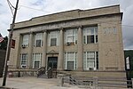
Meeds Memorial United Methodist Church, Nesquehoning, PA

Nesquehoning is a borough in Carbon County, Pennsylvania, United States. It is part of Northeastern Pennsylvania. The population was 3,336 at the 2020 census.Nesquehoning was established as a result of the anthracite coal mining industry. It was incorporated as a borough in 1963 (effective in 1964), having previously been a part of Mauch Chunk Township west of the Lehigh River. The borough's name is of Native American origin, commonly believed to signify "narrow valley;" however native language scholars translate the name as "at the black lick" or "at the dirty lick," referring to mineral licks frequented by deer or other animals.

Excerpt from the Wikipedia article Nesquehoning, Pennsylvania (License: CC BY-SA 3.0, Authors, Images).

Nesquehoning, Pennsylvania
Little Flower Avenue,

Geographical coordinates (GPS) Address Nearby Places
placeShow on map

Wikipedia: Nesquehoning, PennsylvaniaContinue reading on Wikipedia

Geographical coordinates (GPS)

Latitude Longitude
N 40.868055555556 ° E -75.824166666667 °
placeShow on map

Address

Little Flower Avenue

Little Flower Avenue
18240
Pennsylvania, United States
mapOpen on Google Maps

Meeds Memorial United Methodist Church, Nesquehoning, PA
Share experience

Nearby Places

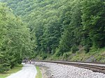
Lehigh Gorge Trail
Lehigh Gorge Trail

The Lehigh Gorge Trail is a 26-mile (42 km) multi-use rail trail that winds along the valley of the Lehigh River Gorge from White Haven, to Jim Thorpe, Pennsylvania. Much of the trail runs through the Lehigh Gorge State Park, and was originally developed into a railroad corridor after an extension of the Lehigh Canal was first built under the great push of Main Line of Public Works to connect the Delaware Valley to Pittsburgh. Dating to 1837, the Lehigh Coal & Navigation Company and its subsidiary Lehigh and Susquehanna Railroad (LH&S RR) worked to tame the rough terrains of the gorge, initially for a northward extension of the Lehigh Canal, then for a railroad graded through passing the twists of the gorge after floods in the later-1840s wiped out the northward extension of the much older (lower) Lehigh Canal, extending down to the industries of Allentown and Philadelphia. LH&S became a holding company in the 1870s and to this day lease the trackage of this important rail corridor to several rail companies with track rights, including Norfolk Southern and the Reading Blue Mountain and Northern Railroad. Parts of the trail are rights of ways of the competing Lehigh Valley Railroad (LVRR), incorporated in the 1870s to bust the monopoly the LH&S had over transit between the Delaware Valley and Wilkes-Barre. Both rail systems were acquired during the Conrail mergers, with parts combined for today's Railbed. The trail is located on the unused remnants, and today is part of the 165-mile (266 km) D & L Trail, which extends northwards along the other abandoned trackage beyond Mountain Top down into the Avoca and Moosic suburbs between Wilkes-Barre and Scranton.