place

Singhofen

Municipalities in Rhineland-PalatinateRhein-Lahn-KreisRhein-Lahn-Kreis geography stubs
Singhofen2
Singhofen2

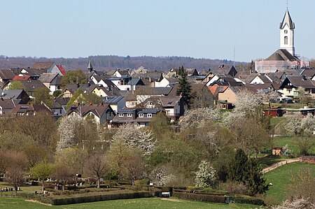
Singhofen is a municipality in the district of Rhein-Lahn, in Rhineland-Palatinate, in western Germany. It belongs to the association community of Bad Ems-Nassau.

Excerpt from the Wikipedia article Singhofen (License: CC BY-SA 3.0, Authors, Images).

Singhofen
Hauptstraße, Bad Ems-Nassau

Geographical coordinates (GPS) Address Nearby Places
placeShow on map

Wikipedia: SinghofenContinue reading on Wikipedia

Geographical coordinates (GPS)

Latitude Longitude
N 50.274444444444 ° E 7.8363888888889 °
placeShow on map

Address

Hauptstraße 48
56379 Bad Ems-Nassau
Rhineland-Palatinate, Germany
mapOpen on Google Maps

Singhofen2
Singhofen2
Share experience

Nearby Places

Langenau Castle
Langenau Castle

Langenau Castle (German: Schloss Langenau) is an old lowland castle in the municipality of Obernhof in the county of Rhein-Lahn-Kreis in the German state of Rhineland-Palatinate. The site of the fortification was the confluence of the Gelbach and the Lahn rivers. As a result, the castle is designed as a lowland type, which is unusual for this region. In 1243 the castle was first mentioned in the will of Countess Mechthild of Sayn who left it to the Archbishopric of Cologne. The archbishop enfeoffed the fortress shortly thereafter to the noble family of Langenau, cousins of the counts of Laurenburg and thus of the House of Nassau. The family kept the castle as a joint inheritance or Ganerbschaft for centuries. The original fortress was turned into a water castle on the construction of a dyke. Today, of the 13th century fortification, only the square Romanesque style bergfried is left. The remaining fortifications, an enceinte and an eight-metre-high shield wall with two flanking towers, show elements of Gothic architecture and appeared in the 14th or 15th centuries. Presumably by the middle of the 14th century, when the Langenaus built New Langenau Castle as their main residence, the castle no longer served as a noble seat, but primarily as a base from which to manage the estate. In 1613 the Langenau family died out. The castle changed ownership several times in the years that followed. In the 17th century, a large timber-framed domestic building was built. In 1696 the mercantile and industrialist family of Marioth purchased the site as their residence and had it converted into a schloss in 1698. In 1847, Countess Giech, a daughter of Prussian reform minister, vom und zum Stein, became the new occupant. She had the schloss converted in 1851 into a hospital and home for children of the poor.

Limes Germanicus

The Limes Germanicus (Latin for Germanic frontier) is the name given in modern times to a line of frontier (limes) fortifications that bounded the ancient Roman provinces of Germania Inferior, Germania Superior and Raetia, dividing the Roman Empire and the unsubdued Germanic tribes from the years 83 to about 260 AD. The Limes used either a natural boundary such as a river or typically an earth bank and ditch with a wooden palisade and watchtowers at intervals. A system of linked forts was built behind the Limes. The path of the limes changed over time following advances and retreats due to pressure from external threats. At its height, the Limes Germanicus stretched from the North Sea outlet of the Rhine to near Regensburg (Castra Regina) on the Danube. These two major rivers afforded natural protection from mass incursions into imperial territory, with the exception of a gap stretching roughly from Mogontiacum (Mainz) on the Rhine to Castra Regina. The Limes Germanicus was divided into: The Lower Germanic Limes, which extended from the North Sea at Katwijk in the Netherlands along the then main Lower Rhine branches (modern Oude Rijn, Leidse Rijn, Kromme Rijn, Nederrijn) The Upper Germanic Limes started from the Rhine at Rheinbrohl (Neuwied (district)) across the Taunus mountains to the river Main (East of Hanau), then along the Main to Miltenberg, and from Osterburken (Neckar-Odenwald-Kreis) south to Lorch (in Ostalbkreis, Württemberg) in a nearly perfect straight line of more than 70 km; The Rhaetian Limes extended east from Lorch to Eining (close to Kelheim) on the Danube.The total length was 568 km (353 mi). It included at least 60 forts and 900 watchtowers. The potentially weakest, hence most heavily guarded, part of the Limes was the aforementioned gap between the westward bend of the Rhine at modern-day Mainz and the main flow of the Danube at Regensburg. This 300-kilometre-wide (190 mi) land corridor between the two great rivers permitted movement of large groups of people without the need for water transport, hence the heavy concentration of forts and towers there, arranged in depth and in multiple layers along waterways, fords, roads, and hilltops.