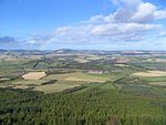
Bonnyton, Aberdeenshire
Aberdeenshire geography stubsVillages in Aberdeenshire

Bonnyton is a rural area of Old Rayne in the Garioch area of Aberdeenshire, Scotland.Bonnyton is a small secluded hamlet comprising seven houses, at the end of a no through road. Elevation approx. 500 feet. South facing views towards the Bennachie range. It is situated a mile and half from the Main A96 Aberdeen/Inverness trunk road. The local village with shops is at Insch It is surrounded by the farms of Loanhead, Lathries, Oxenloan and St Cloud. A caravan site is situated in the area.
Excerpt from the Wikipedia article Bonnyton, Aberdeenshire (License: CC BY-SA 3.0, Authors, Images).Bonnyton, Aberdeenshire
Lawrence Road,
Geographical coordinates (GPS) Address Nearby Places Show on map
Geographical coordinates (GPS)
| Latitude | Longitude |
|---|---|
| N 57.365737 ° | E -2.539654 ° |
Address
Lawrence Road
Lawrence Road
AB52 6SD
Scotland, United Kingdom
Open on Google Maps


