place

Bagshaw

Chapel-en-le-FrithDerbyshire geography stubsTowns and villages of the Peak DistrictVillages in Derbyshire
Bagshaw Methodist Chapel cropped 054856

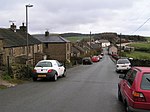
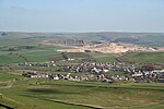
Bagshaw is a hamlet in Derbyshire, England. The hamlet falls within the civil parish of Chapel-en-le-Frith. It is about 1.2 km or 0.75 miles east of Chapel-en-le-Frith, and within the boundaries of the Peak District National Park. It is in the valley of a small stream which flows westward towards the Black Brook. It has a small Methodist chapel.

Excerpt from the Wikipedia article Bagshaw (License: CC BY-SA 3.0, Authors, Images).

Bagshaw
Sheffield Road, High Peak Chapel-en-le-Frith

Geographical coordinates (GPS) Address Nearby Places
placeShow on map

Wikipedia: BagshawContinue reading on Wikipedia

Geographical coordinates (GPS)

Latitude Longitude
N 53.3272 ° E -1.8836 °
placeShow on map

Address

Bagshaw House

Sheffield Road
SK23 0QU High Peak, Chapel-en-le-Frith
England, United Kingdom
mapOpen on Google Maps

Bagshaw Methodist Chapel cropped 054856
Share experience

Nearby Places

The Bull Ring
The Bull Ring

The Bull Ring is a Class II henge that was built in the late Neolithic period near Dove Holes in Derbyshire, England.It has coordinates 53.300695°N 1.884423°W / 53.300695; -1.884423 (grid reference SK 0785 7823), and is National Monument number 23282. There are also two barrows about 20m away from the henge; one oval, one bowl.The henge consists of a large, circular earthwork, which is currently about 1 metre (3 ft) high and 9–11 metres (30–36 ft) wide; however it was originally 2 metres (7 ft) high and 5.5–7 metres (18–23 ft) wide. The henge has a ditch on the inside, which varies between 0.5 and 1 metre (1 ft 8 in and 3 ft 3 in) deep and 8 and 12 metres (26 and 39 ft) wide; it was originally 1.2–2 metres (3 ft 11 in – 6 ft 7 in) deep and 5–6.5 metres (16–21 ft) wide. The ditch and bank are separated by a berm, which was originally 5 metres (16 ft) wide. It encloses an area 53 (north–south) by 46 (east–west) metres, with entrances to the north and south, each of which have a causeway across the ditch. A skeleton was reputedly found near the north entrance; this entrance was also damaged in the 19th century by quarrying. The centre of the henge was ploughed in the 18th century; a drystone wall was also built across the site during the same era.A single standing stone (orthostat) was recorded as remaining in 1789 by Pilkington, potentially the remnant of a stone circle. It has been suggested that stones from the henge were used as sleepers for the Peak Forest Tramway circa 1790.A minor excavation was carried out in the west ditch in 1902 by Micah Salt; this reputedly discovered some pottery sherds and flint flakes, which have since been lost. A trial excavation by Oxford University Archaeological Society in 1949 established that the ring has two entrances, and also provided information about the original size of the bank and ditch. However, it did not provide any evidence of stones on the site. The excavation also turned up flint flakes, as well as a rim from a pottery food vessel.A third excavation was carried out in 1984 outside the south entrance, which found further flint flakes and pottery, several pits, and stakeholes of a fence following the henge bank, which are potentially original features of the henge. Most recently, magnetometer and earth resistance surveys were carried out in 2000, with no conclusive results.The oval barrow to the south-west of the henge is about 27 by 21 metres (89 ft × 69 ft), and is approximately 2.5 metres (8 ft 2 in) high. It was constructed some time in the early to mid-Neolithic period. A later (late Neolithic to late Bronze Age) bowl barrow is superimposed on it. The summit of the oval barrow was disturbed by a World War II slit trench; the edges of the barrow have also been disturbed by ploughing as well as a drystone wall, which has subsequently been removed. The barrow has not been excavated.

Dove Holes
Dove Holes

Dove Holes is a village in the High Peak district of Derbyshire, England. It has a population of about 1,200 (2001), shown in the 2011 Census as being included in the population of Chapel-en-le-Frith. It straddles the A6 road approximately three miles north of Buxton and three miles south of Chapel-en-le-Frith. Trains run from Dove Holes railway station into Manchester. Residents of the village live either in the village or on outlying farms. There are around six farms in the village and many more within the boundaries of the parish. There are also large limestone quarries that, over the years, have made an important contribution to the development and economy of the village. Additionally, there are several businesses. There are two public houses, one of which offers accommodation. There is a daily milk delivery service and a mobile library every fortnight. There is a church, Methodist chapel and a community centre. The village lies on the fringe of the Peak District National Park. Evidence of human occupation at Dove Holes can be traced back to the Neolithic Period (late Stone Age) because of the existence of a henge, known locally as The Bull Ring, and an adjoining tumulus. In the Middle Ages, the area was used as the royal hunting Forest of High Peak (now known as Peak Forest), an area set aside as a royal hunting forest. The village's name is believed to derive from the Celtic word dwfr (dŵr in modern Welsh), which means water, hence Water Holes or Dove Holes. The same word is the origin of the name 'Dover' for the famous Channel ferryport. In 1650, a General Survey of the Manor of High Peak was made to assess the property of the late King Charles. This recorded that people were burning limestone around the village and that there were 14 kilns thereabouts, the burnt lime (quicklime) being slaked and used by farmers to condition the soil in their fields. At that time, lime kilns could be built and demolished without authority. With the coming of the Industrial Revolution, and the opening of the Peak Forest Tramway in 1796, the limestone quarries were commercialised. The first of these was at nearby Loads Knowl and others quickly followed along Dove Holes Dale. Undoubtedly, the opening of the Peak Forest Tramway and the consequent expansion of commercial limestone quarries contributed greatly to the expansion of the village. For the first time, there was an outlet for limestone in Manchester via the Peak Forest Tramway, Bugsworth Basin, the Peak Forest Canal and the Ashton Canal. Buxton Mountain Rescue Team has been based in Dove Holes since the 1970s. Their present base in the village was opened in 1990 by HRH Diana Princess of Wales.There is a High Peak bus company garage on the east side of the A6, replacing the one which used to be in Buxton. In 2001, the village was voted the ugliest village in Britain in a Radio 5 Live poll. However Dove Holes railway station was chosen in 2019 to feature in the music video for the chart-topping single "Someone You Loved" by singer Lewis Capaldi.Cemex operate a quarry in Dove Holes.