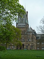
Aldcliffe

Aldcliffe is a hamlet, and former township and civil parish, in the civil parish of Aldcliffe-with-Stodday, south-west of Lancaster in Lancashire, England. The hamlet is located on the east bank of the River Lune, and is one and a half miles south west of the Lancaster city centre.The name can be split into two parts, ald which roughly means 'old', and clif which means 'high ground'. There are also a number of different variations over the centuries: Aldeclif (1086), Audecliva (1094), Audeclyviam (1190), Aldeclive (1212), Aidedyf (1341), Auclyff (1577), Awcliffe (1577), Adclife, Aldcliffe, Alclife, Aldclif, Aldclife, Aldclyffe, Altlife, Auldcliffe, Auckliff, Aucliff, Aucliffe and Aukliffe. The first part of the name may also be the Brittonic alt meaning "a steep height or hill, a cliff".The traditional pronunciation is "Awcliffe" while "A 1 d cliff e" may have been the ancient and the newcomer's pronunciation.
Excerpt from the Wikipedia article Aldcliffe (License: CC BY-SA 3.0, Authors, Images).Aldcliffe
Lancaster Aldcliffe-with-Stodday
Geographical coordinates (GPS) Address Nearby Places Show on map
Geographical coordinates (GPS)
| Latitude | Longitude |
|---|---|
| N 54.034 ° | E -2.815 ° |
Address
LA1 5BQ Lancaster, Aldcliffe-with-Stodday
England, United Kingdom
Open on Google Maps


