Cholmondeley, Cheshire

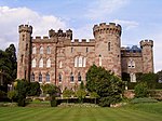
Cholmondeley ( CHUM-lee) is a civil parish in Cheshire, England, north east of Malpas and west of Nantwich. It includes the small settlements of Croxton Green (SJ552527) and Dowse Green (SJ561517), with a total population of a little over a hundred, increasing to 157 at the 2011 Census. Nearby villages include Bickerton to the north east, Bulkeley to the north, Chorley to the east, No Man's Heath to the south west, and Bickley Moss to the south. The name means "clearing of Ceolmund", this being an Old English forename made up of the elements ceol, "ship", and mund, "protection".Cholmondeley Castle is in Cholmondeley and much of the civil parish falls within the Cholmondeley Estate, owned by the Marquess of Cholmondeley. Its parkland includes mixed woodland and plantations, lakes, gardens and farmland.
Excerpt from the Wikipedia article Cholmondeley, Cheshire (License: CC BY-SA 3.0, Authors, Images).Cholmondeley, Cheshire
Camellia Walk,
Geographical coordinates (GPS) Address Nearby Places Show on map
Geographical coordinates (GPS)
| Latitude | Longitude |
|---|---|
| N 53.057088 ° | E -2.691637 ° |
Address
Camellia Walk
SY14 8EZ , Cholmondeley
England, United Kingdom
Open on Google Maps


