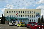
place

Czerwonak

Poznań County geography stubsVillages in Poznań County

Czerwonak [t͡ʂɛrˈvɔnak] (German: Rotental) is a village in Poznań County, Greater Poland Voivodeship, in west-central Poland. It is the seat of the gmina (administrative district) called Gmina Czerwonak. It lies on the east bank of the Warta River, approximately 9 km (6 mi) north-east of the regional capital Poznań, on the main road and railway line leading to Murowana Goślina, Skoki and Wągrowiec. In 2006 Czerwonak had a population of 5,432. The village of Koziegłowy, which borders Czerwonak to the south, has an even larger population. Czerwonak adjoins the protected forest area known as Puszcza Zielonka Landscape Park. About 2 kilometres (1 mi) north-east of the village is the hill and observation tower of Dziewicza Góra, which is the Park's highest point.

Excerpt from the Wikipedia article Czerwonak (License: CC BY-SA 3.0, Authors).

Czerwonak
Gdyńska, gmina Czerwonak

Geographical coordinates (GPS) Address Nearby Places
placeShow on map

Wikipedia: CzerwonakContinue reading on Wikipedia

Geographical coordinates (GPS)

Latitude Longitude
N 52.469722222222 ° E 16.980833333333 °
placeShow on map

Address

Gdyńska 50
62-004 gmina Czerwonak
Greater Poland Voivodeship, Poland
mapOpen on Google Maps

Share experience

Nearby Places

Stare Miasto, Poznań

Stare Miasto (Polish pronunciation: [ˈstarɛ ˈmjastɔ]) is a part of the city of Poznań in western Poland. It was one of the five governmental districts (dzielnicas) into which the city was divided prior to 1990, and which are retained for certain administrative purposes. For details, see Administrative division of Poznań. The Polish name Stare Miasto means "Old Town". In discussing subdivisions of Poznań, the name is ambiguous; it may refer to: the whole area of the former dzielnica of Stare Miasto; the osiedle called Stare Miasto, covering most of the city centre; or the Poznań Old Town neighbourhood, covering only the area of the original walled city.In this article, Stare Miasto will have the first of the above meanings. For the osiedles contained within this district, see Administrative division of Poznań. The district of Stare Miasto includes Poznań Old Town and most of the remainder of the city centre, as well as the northern part of the city, including the modern residential areas of Winogrady and Piątkowo, and the less densely populated northernmost neighbourhoods of Morasko and Radojewo. It has an area of 47.1 square kilometres (18.2 sq mi) and a population of 161,200, making it the most populous of the city's five districts. Stare Miasto borders the districts of Nowe Miasto ("New Town") to the east (across the Warta river), Wilda to the south, and Jeżyce and Grunwald to the west. It is also bordered by the administrative districts (gminas) of Suchy Las to the north and Czerwonak across the Warta (though without any direct crossing) to the east.