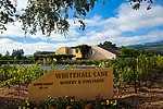
Zinfandel, California
Napa County, California geography stubsNapa ValleyUnincorporated communities in CaliforniaUnincorporated communities in Napa County, CaliforniaUse mdy dates from July 2023
Zinfandel (formerly, Bell Station and Pine Station) is a small unincorporated community in Napa County, California just south of the city of St. Helena in the North Bay region of the San Francisco Bay Area. It is part of the Wine Country. It is located at the intersection of the St. Helena Highway (State Route 29) and Zinfandel Lane and comprises about 14 square blocks, most of which are rural and residential in character. The ZIP Code is 94567. The community is inside area code 707. The town was named after a grape and a variety of wine produced from that grape.
Excerpt from the Wikipedia article Zinfandel, California (License: CC BY-SA 3.0, Authors).Zinfandel, California
Zinfandel Lane,
Geographical coordinates (GPS) Address Nearby Places Show on map
Geographical coordinates (GPS)
| Latitude | Longitude |
|---|---|
| N 38.482777777778 ° | E -122.44222222222 ° |
Address
Zinfandel Lane 1193
94574
California, United States
Open on Google Maps


