place

Mattituck, New York

Census-designated places in New York (state)Census-designated places in Suffolk County, New YorkHamlets in New York (state)Hamlets in Suffolk County, New YorkPopulated coastal places in New York (state)
Southold, New YorkUse mdy dates from July 2023
AER 03.06 INLET
AER 03.06 INLET

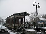
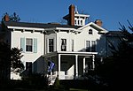
Mattituck is a hamlet and census-designated place (CDP) in Suffolk County, New York, United States. The population was 4,584 in 2023 according to the World Population Review. Located in the Town of Southold, Mattituck CDP roughly corresponds to the hamlet by the same name.

Excerpt from the Wikipedia article Mattituck, New York (License: CC BY-SA 3.0, Authors, Images).

Mattituck, New York
Maiden Lane,

Geographical coordinates (GPS) Address Nearby Places
placeShow on map

Wikipedia: Mattituck, New YorkContinue reading on Wikipedia

Geographical coordinates (GPS)

Latitude Longitude
N 40.994722222222 ° E -72.537222222222 °
placeShow on map

Address

Maiden Lane 295
11952
New York, United States
mapOpen on Google Maps

AER 03.06 INLET
AER 03.06 INLET
Share experience

Nearby Places

Fort Corchaug Archaeological Site

Fort Corchaug Archeological Site is a prehistoric archaeological site in Cutchogue on eastern Long Island in New York State. It is located west of the North Fork Country Club, on the south side of Main Road (New York State Route 25). The site shows evidence of 17th century contact between Native Americans and Europeans. Fort Corchaug itself was a log fort built by Native Americans. It may have been to protect the Corchaug tribe from other Indians, built with the help of Europeans. Ralph Solecki, a prominent American archaeologist, grew up nearby and conducted several digs on site.It remains today one of the few undisturbed Native American fortified village sites in the North East. and was declared a National Historic Landmark in 1999. The 105-acre (42 ha) property where the fort is located is protected in part by a conservation easement owned by a local land trust, and is in part owned by the town of Southold as a nature preserve. Known as the Downs Farm Preserve, it is open to the public with hiking trails.The Corchaug tribe, also known as the Montaukett, originally had the land from the Nassau border to Montauk Point. Depradation by the Narragansetts of Connecticut and decimation from smallpox caused to tribe to leave their land in the South Fork and with the help of whites built forts to ward off attacks. Another fort still being excavated is Fort Hill (now in Montauk County Park) in Montauk Point, described as "one of the earliest and best for its time", it was placed on a 1658 map of Long Island.