place

East Moriches, New York

Brookhaven, New YorkCensus-designated places in New York (state)Census-designated places in Suffolk County, New YorkHamlets in New York (state)Hamlets in Suffolk County, New York
Pages including recorded pronunciationsPopulated coastal places in New York (state)TWA Flight 800Use mdy dates from July 2023
East Moriches welcome

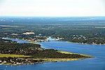
East Moriches ( moh-RITCH-iz) is a hamlet and census-designated place in the Town of Brookhaven, Suffolk County, New York, United States. The population was 5,249 at the 2010 census.The name Moriches comes from Meritces, a Native American who owned land on Moriches Neck.

Excerpt from the Wikipedia article East Moriches, New York (License: CC BY-SA 3.0, Authors, Images).

East Moriches, New York
Thoroughbred Court,

Geographical coordinates (GPS) Address Nearby Places
placeShow on map

Wikipedia: East Moriches, New YorkContinue reading on Wikipedia

Geographical coordinates (GPS)

Latitude Longitude
N 40.806388888889 ° E -72.756666666667 °
placeShow on map

Address

Thoroughbred Court
11940
New York, United States
mapOpen on Google Maps

East Moriches welcome
Share experience

Nearby Places

Moriches Inlet
Moriches Inlet

Moriches Inlet ( moh-RITCH-iz) is an inlet connecting Moriches Bay and the Atlantic Ocean. The name Moriches comes from Meritces, a Native American who owned land on Moriches Neck.It forms the eastern border of Fire Island, New York and the western border of the barrier island on which West Hampton Dunes, New York is the closest community. The inlet was present on Fire Island until it closed up during the 1800s. The inlet which split West Hampton from Fire Island was reformed by a Nor'easter in 1931. The 1931 storm created a geographic quirk for the western tip of the West Hampton island which is in the town of Brookhaven but in order to access it via land from Brookhaven a person must go through several miles of Southampton, New York. Between 1933 and 1938 Moriches Inlet widened to 4,000 feet (1,200 m) wide and deepened with sand being deposited on both the bay and ocean. The widening subsided in 1938 when the Great Hurricane of 1938 opened up the Shinnecock Inlet further east between Shinnecock Bay and the ocean. In an attempt to stabilize the deterioration of the barrier island, local authorities built groines on the inlet in 1952–1953. Local authorities have consistently urged that the inlet be kept open to allow boats from the mainland of Long Island to have access to the ocean. The United States Army Corps of Engineers took over the maintenance of the inlets and jetties in the 1980s. The Corps in turn ran into controversy with claims that the groynes and jetties were blocking the natural east to west longshore drift that replenished sand. The inlet and groynes were to be blamed for a loss of 8–10 million cubic yards of sand on Fire Island—representing a loss of 100 feet (30 m) of beach and a depth of 12–16 feet along the entire 32-mile (51 km) Fire Island beach zone.The inlet was the initial primary water access route for recovery ships following the July 17, 1996, crash of TWA Flight 800, which broke up in flight and crashed into the ocean about 8 miles (13 km) from the inlet; throughout the night of July 17-18, boats carrying human remains and aircraft debris passed from the debris field through Moriches Inlet to the East Moriches United States Coast Guard station, before recovery-vessel traffic was shifted to Shinnecock Inlet (18 miles (29 km) to the northeast of the debris field) on July 18 due to the latter inlet's wider, calmer waters.

Moriches Bay
Moriches Bay

Moriches Bay ( moh-RITCH-iz) is a lagoon system on the south shore of Long Island, New York. The name Moriches comes from Meritces, a Native American who owned land on Moriches Neck.Two townships in Suffolk, New York (Brookhaven and the Southampton) share its shoreline. Moriches Bay is east of the Mastic Narrows and Great South Bay and west of Shinnecock Bay. The bay is 62 miles (100 km) east of New York City. Moriches Bay has a body of water of 9,480-acre (3,840 ha) of aquatic environment. This includes Moneybogue Bay and Quantuck Bay, its salt marshes, dredged material islands, and intertidal flats. This body of water is between the Outer barrier islands and Long Island mainland. Its flow comes from the Moriches and Shinnecock Inlets) The western boundary of this bay is the Smith Point Bridge; the eastern boundary is the eastern edge of Quantuck Bay. This bayside habitat includes the tidal creeks and marshes feeding into Moriches Bay from the Long Island mainland. A thriving habitat off the Atlantic Ocean, the Moriches Bay is used by Long Islanders for local fishing. It is a natural habitat for shellfish, migrating and wintering waterfowl, colonial nesting waterbirds, beach-nesting birds, migratory shorebirds, raptors, and rare plants. The Great South Bay and Moriches Bay seabeds up to the barrier beach are owned by the towns through a grant by the British monarch long before the existence of the United States. It has been repeatedly adjudicated (even to the U.S. Supreme Court) that the land grants in the Dongan (Governor of New York) patents (Islip, Brookhaven, Southampton and East Hampton Towns, 1686) are valid. However, since 1968 the federal government has been attempting to take title of and lay claim to, by adverse possession, the bay bottoms of Islip and Brookhaven towns extending outward from the barrier beach.