place

Wood Street railway station

DfT Category D stationsFormer Great Eastern Railway stationsLondon stations without latest usage statistics 1415London stations without latest usage statistics 1516Proposed London Underground stations
Rail transport stations in London fare zone 4Railway depots in LondonRailway stations in Great Britain opened in 1873Railway stations in the London Borough of Waltham ForestRailway stations served by London OvergroundUnbuilt London Underground stationsUse British English from October 2013Walthamstow
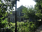
Wood Street stn entrance

Wood Street is a railway station on the Chingford branch of the Lea Valley lines, located in Upper Walthamstow in the London Borough of Waltham Forest, east London. It is 7 miles 7 chains (11.4 km) down the line from London Liverpool Street and is situated between Walthamstow Central and Highams Park. It has been operated by London Overground since 2015. It is also occasionally known as "Walthamstow Wood Street". The station is in Travelcard Zone 4. The station is close to Whipps Cross University Hospital.

Excerpt from the Wikipedia article Wood Street railway station (License: CC BY-SA 3.0, Authors, Images).

Wood Street railway station
Wood Street, London Leytonstone

Geographical coordinates (GPS) Address Nearby Places
placeShow on map

Wikipedia: Wood Street railway stationContinue reading on Wikipedia

Geographical coordinates (GPS)

Latitude Longitude
N 51.5864 ° E -0.0021 °
placeShow on map

Address

Wood Street Supermarket

Wood Street 173
E17 3NU London, Leytonstone
England, United Kingdom
mapOpen on Google Maps

Wood Street stn entrance
Share experience

Nearby Places

Walthamstow
Walthamstow

Walthamstow ( or ) is a large town in east London, England, within the ceremonial county of Greater London and the ancient county of Essex. Situated 7+1⁄2 miles (12 kilometres) northeast of Charing Cross, the town borders Chingford to the north, Snaresbrook and South Woodford to the east, Leyton and Leytonstone to the south, and Tottenham to the west. At the 2011 census, the town had a population of approximately 109,424. Occupying most of the town's east-to-west High Street, Walthamstow Market is the longest outdoor market in Europe. East of the town centre is Walthamstow Village, the oldest part of Walthamstow, and the location of St Mary's Church, the town's parish church. To the north of the town is the former Walthamstow Stadium, which was considered an East End landmark. The William Morris Gallery in Forest Road, a museum that was once the family home of William Morris, is a Grade II* listed building. The town is served by five railway stations, including Walthamstow Central and Blackhorse Road—interchange stations on the Victoria line of the London Underground. The administrative centre of the London Borough of Waltham Forest, a local government district of Greater London, Walthamstow was a civil parish, originally part of the Becontree Hundred of Essex. Similar to much of south-west Essex, the town expanded rapidly in the 19th century, becoming a suburb in the urban area of London. It has formed part of the Metropolitan Police District since 1840, and the London postal district since its inception in 1856. The parish became a local board district in 1873, an urban district in 1894 and a municipal borough in 1929. Following reform of local government in London in 1965, it merged with the municipal boroughs of Chingford and Leyton to form the new Waltham Forest local authority district, moving from the administrative county of Essex to the newly-formed Greater London council area. The borough council is based at the former Walthamstow Town Hall in Forest Road.