place

Stora Essingen

Districts of StockholmIslands of MälarenIslands of StockholmStockholm County geography stubs
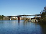
Stora Essingen September 2014 01

Stora Essingen is an island and a district in the Kungsholmen borough in Stockholm, Sweden. It is located adjacent to Lilla Essingen on Lake Mälaren. Both Essingen Islands are mainly residential areas. Stora Essingen is scattered with private houses and apartment buildings. The Essingeleden motorway, part of European route E4, passes along a section of the eastern shore. The Tvärbanan light rail passes near the eastern shore and has one stop on the island.

Excerpt from the Wikipedia article Stora Essingen (License: CC BY-SA 3.0, Authors, Images).

Stora Essingen
Badstrandsvägen, Stockholm Stora Essingen (Kungsholmens stadsdelsområde)

Geographical coordinates (GPS) Address Nearby Places
placeShow on map

Wikipedia: Stora EssingenContinue reading on Wikipedia

Geographical coordinates (GPS)

Latitude Longitude
N 59.321111111111 ° E 17.988888888889 °
placeShow on map

Address

Badstrandsvägen 34
112 64 Stockholm, Stora Essingen (Kungsholmens stadsdelsområde)
Sweden
mapOpen on Google Maps

Stora Essingen September 2014 01
Share experience

Nearby Places

Alviksbron
Alviksbron

Alviksbron (Swedish for The Alvik Bridge) is a box girder bridge in central Stockholm, Sweden. Stretching over Oxhålssundet, it connects Stora Essingen island to the western suburb Bromma. Built 1996-1998 by the Nordic Construction Company at a cost of 180 million SEK, it has served the Tvärbanan light rail line and pedestrians and bicyclists since its inauguration in August 2000. The name is derived from Alvik, originally a local manor house built in 1819 and demolished in 1930.The bridge is 400 metres in length with a 140-metre central span and a horizontal clearance of 24 metres. The underside of the bridge tie forms an arch intended to make the bridge as slender as possible. The two pillars standing in the water each consist of two thin concrete plates dressed in two-quarters brick with a common concrete foundation. They are illuminated after dark.The construction is pre-tensioned longitudinally by cables, but non-tensioned across. The topside was stretched as the separate sections were added, while the underside was stretched after all the sections had been cast into a single compact unit.Three years after the inauguration crack formations were discovered in the bridge. The shear fissures in the ribs had an angle of 25-30° and a length of 0.1-0.3 mm, and were found in greater number on the south side. This is thought to indicate that compressive stress from the longitudinal stressing in combination with heat from the sun caused the problem. The bridge was then reinforced, first temporarily using outside pre-stressing bars, and then permanently using carbon fibre laminates in sections with minor fissures, and tie struts in the worst affected sections.

Essingebron
Essingebron

Essingebron (Swedish: "The Essinge Bridge") are two parallel bridges in central Stockholm, Sweden, inaugurated August 21, 1966, and September 3, 1967. Forming a section of the Essingeleden motorway they connect the two islands Stora Essingen and Lilla Essingen and are the most heavily trafficked bridges in Sweden. The current bridges replaced a bridge called Stora Essingebron ("The Larger Essinge Bridge") inaugurated on May 10, 1965, as the motorway being built then resulted in a number of bridges connecting to Stora Essingen and the name was considered ambiguous. (See also Mariebergsbron). The motorway bridges are paralleled by a bridge for local use, Gamla Essinge Broväg ("Old Essinge Bridge road").The increasing number of summer residences built on Stora Essingen during the 18th century were during the early 20th century gradually transformed into permanent residences. Therefore, a first temporary Stora Essingebron was built in 1917 using the rafts of the X-shaped pontoon bridge once in service on the ice of Lake Riddarfjärden during winters. Across the central seaway, a hand-pulled ferry connected the two pathways until replaced by a flap in 1921.Finally in 1927 the City Council decided on building a permanent bridge, inaugurated the following year. The central part of the steel construction spanned the 185 metres between the islands using five 40 metres long spans, and was continuous on both sides with viaducts giving the entire bridge a total length of 339 metres. It was 7,6 metres wide with a 5,2 metres wide roadway, and offered an horizontal clearance of 13 metres. A severe bus accident in 1948 when a bus crashed through a railings of the bridge killing 11, lead to an examination of the bridge in 1951, followed by reinforcement by draw barriers and the amelioration of the pile foundation.In contrast to many of the other bridges in Stockholm, the route passing over the bridge was a cul-de-sac, and the bridge could therefore handle the increasing post-WW2 traffic load. However, with the construction of the Essingeleden motorway, the old bridge had to be scrapped and replaced by a new, inaugurated in 1966. Gamla Essinge Broväg is 470 metres long; 11 metres wide with an 8 metres roadway; and offers a horizontal clearance of 16 metres between the major 100 metres wide span.October 14, 2005, the pontoon crane 'Lodbrok' collided with the bridge, causing a major traffic jam.

Alvik metro station
Alvik metro station

Alvik metro station is a station on the Green line of the Stockholm metro, and on the Tvärbanan and Nockebybanan lines of Stockholm tramways. It is located on the border between the districts of Traneberg and Alvik, which are part of the borough of Bromma in the west of the city of Stockholm. The station is one of the intermediate termini along the northern section of the Green line, with line 18 trains normally terminating, and is also the terminus of the Nockebybanan.Alvik station has tracks on two levels, both above ground. The higher level has two island platforms aligned east-west and serving four tracks. The outer pair of tracks are through tracks used by metro trains, whilst the inner pair of tracks are used to terminate Nockebybanan trams, thus providing cross-platform interchange between the Nockebybanan and metro. The lower level, which is at street level, has a pair of side platforms, aligned north-south and just to the west of the higher level platforms, which are used by trams on the Tvärbanan.At the west end of the station, a complex set of elevated tracks ensures that metro trains and trams on both lines are segregated from each other. The metro and the Nockeby tramway are also connected by shared tracks (electrified with both third rail and overhead lines) to the nearby Brommadepån tram depot. Metro trains terminating at Alvik use reversing tracks within the depot to switch between westbound and eastbound metro platforms. A curved tunnel also connects the depot to the lower Tvärbanan tracks, thus allow stock interchange between the two tram lines.