place

High Lane, Greater Manchester

Geography of the Metropolitan Borough of StockportTowns and villages of the Peak DistrictVillages in Greater Manchester
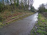
High Lane Arm bridge geograph.org.uk 61237

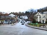
High Lane is a village in the Metropolitan Borough of Stockport, Greater Manchester, England, on the Macclesfield Canal, 5 miles (8 km) from Stockport.

Excerpt from the Wikipedia article High Lane, Greater Manchester (License: CC BY-SA 3.0, Authors, Images).

High Lane, Greater Manchester
Buxton Road,

Geographical coordinates (GPS) Address Nearby Places
placeShow on map

Wikipedia: High Lane, Greater ManchesterContinue reading on Wikipedia

Geographical coordinates (GPS)

Latitude Longitude
N 53.364 ° E -2.068 °
placeShow on map

Address

Red Lion

Buxton Road 116
SK6 8ED , Disley
England, United Kingdom
mapOpen on Google Maps

High Lane Arm bridge geograph.org.uk 61237
Share experience

Nearby Places

Middlewood railway station

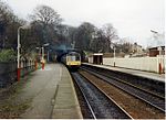
Middlewood railway station serves the village of High Lane in the Metropolitan Borough of Stockport, Greater Manchester, England. It is on the Stockport to Buxton line, opened in 1879 by the London and North Western Railway on the Stockport, Disley and Whaley Bridge Railway which they had acquired in 1866. The construction and opening of the station was concurrent with the construction and opening of the adjacent Middlewood Higher station on the Macclesfield, Bollington and Marple Railway to provide an interchange for passengers wishing to travel between Macclesfield and Buxton with the two stations linked by a flight of steps. Originally named as Middlewood for Norbury the station was renamed three times. In 1899 it became Middlewood for High Lane; then in 1951 it was retitled Middlewood Lower before becoming simply Middlewood in 1968.The station is managed and served by Northern and is the last station in the Transport for Greater Manchester ticketing area. There is no vehicular access to the station. Access is only by woodland paths, the nearest road being some 870 yards (800 m) away. It is one of the three stations that provide access to the Middlewood Way. In July 2009, Poynton Town Council announced that they would be part funding with the aid of a grant from the High Peak and Hope Valley Community Rail Partnership, the installation of a Cycle Rack and Improved Signage to and at the station. These improvements have now been implemented, along with the installation of additional lighting, a new PA system and a Hearing Induction Loop. In June 2016, a landslip at the station following heavy rain meant that all services were suspended between Hazel Grove and Buxton until 25 June. Parts of the track and platform were both affected.

Middlewood Higher railway station

Middlewood Higher railway station was a railway station located near to the village of High Lane in Cheshire, England (now in Greater Manchester). It was opened in 1879 by the Macclesfield, Bollington and Marple Railway (MB&M) – a joint line constructed and operated by the Manchester, Sheffield and Lincolnshire Railway (MS&L) and North Staffordshire Railways (NSR). The station owed its existence to the desire to create an interchange between the MB&M and the London and North Western Railway (LNWR) route between Stockport and Buxton. Without the interchange, people wishing to travel between Macclesfield and Buxton had to travel to Stockport to change trains and then travel back on themselves to get to Buxton. The board of the MB&M proposed to the LNWR that both companies should open a station where the two lines crossed at Middlewood, to allow passengers to save a considerable distance and time in their travel; the LNWR agreed and both the MB&M station, known simply as Middlewood, and the LNWR's Middlewood for Norbury station opened on 2 June 1879. They were connected by a flight of steps.While this allowed for passenger interchange, the layout did not allow for goods interchange and, in 1882, discussion started on connecting the two lines by a rail link. The NSR and the LNWR agreed terms, but the MS&L could not agree running powers with the LNWR, so the NSR and LNWR agreed to proceed on their own. The resulting section of line known as the Middlewood curve opened on 20 May 1885. Most train services on the MB&M were run using MS&L engines and rolling stock but, because of the running power agreement, services between Macclesfield and Buxton were provided by the NSR.The station buildings, including the platforms, were all of timber construction and was built on an embankment. This made it susceptible to subsidence and landslips. In 1955, part of the down (towards Manchester) platform and the waiting shelter were lost when the embankment collapsed. As the usage of the station was not high, replacing the lost section was considered uneconomic and reconstruction was not carried out; however, there are some remains of the support pillars for both sides of the station.As the station served a sparsely populated area, and there were two other stations (Higher Poynton and High Lane) close by, the number of people using the Middlewood Higher (as it had been renamed in 1951) was not high and, in 1960, after consultation, the station closed.When all of the MB&M closed in 1970, the track was lifted, although the bridge across the Buxton line remains. The trackbed now forms part of the Middlewood Way, a recreational path between Macclesfield and Marple.