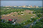
Barton Creek Greenbelt
All pages needing factual verificationForests of TexasGreen beltsParks in Austin, TexasProtected areas of Travis County, Texas ... and 1 more
Urban forests in the United States

The Barton Creek Greenbelt located in Austin, Texas is managed by the City of Austin's Park and Recreation Department. The Greenbelt is a 7.25-mile (11.67 km) stretch of public land that begins at Zilker Park and stretches South/Southwest to the final section commonly referred to as "The Hill of Life" which ends in the Woods of Westlake subdivision. The Barton Creek Greenbelt consists of three areas: the Lower Greenbelt, the Upper Greenbelt, and the Barton Creek Wilderness Park and is characterized by large limestone cliffs, dense foliage, and shallow bodies of water.
Excerpt from the Wikipedia article Barton Creek Greenbelt (License: CC BY-SA 3.0, Authors, Images).Barton Creek Greenbelt
South Mopac Service Road, Austin
Geographical coordinates (GPS) Address Nearby Places Show on map
Geographical coordinates (GPS)
| Latitude | Longitude |
|---|---|
| N 30.243888888889 ° | E -97.809722222222 ° |
Address
South Mopac Service Road
South Mopac Service Road
78745 Austin
Texas, United States
Open on Google Maps


