Banchory-Devenick

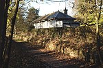
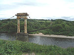
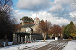
Banchory-Devenick (Scottish Gaelic: Beannchar Dòmhnaig) is a hamlet approximately two kilometres south of the city of Aberdeen, Scotland in the Lower Deeside area of Aberdeenshire. The hamlet should not be confused with the historic civil parish of the same name which spanned the River Dee until 1891, its northern part lying in Aberdeenshire and its southern part in Kincardineshire. In that year the northern part became part of the neighbouring parish of Peterculter, the southern part (including the hamlet itself) remaining as the parish of Banchory-Devenick. The hamlet of Banchory-Devenick is on the B9077 road, and the ancient Causey Mounth passes directly through it. An historic graveyard dating to 1157 AD is present within Banchory-Devenick. Other historic features in the vicinity include Saint Ternan's Church, Muchalls Castle and the Lairhillock Inn.
Excerpt from the Wikipedia article Banchory-Devenick (License: CC BY-SA 3.0, Authors, Images).Banchory-Devenick
B9077,
Geographical coordinates (GPS) Address Nearby Places Show on map
Geographical coordinates (GPS)
| Latitude | Longitude |
|---|---|
| N 57.112777777778 ° | E -2.1563888888889 ° |
Address
B9077
AB12 5YN
Scotland, United Kingdom
Open on Google Maps


