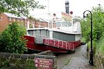
Hulme Walfield
Cheshire geography stubsCivil parishes in CheshireVillages in Cheshire

Hulme Walfield is a small village and civil parish, just north of Congleton, in the unitary authority of Cheshire East and the ceremonial county of Cheshire. It is home to most of Westlow Mere. According to the 2001 census, the population of the civil parish was 140, increasing slightly to 148 at the 2011 Census
Excerpt from the Wikipedia article Hulme Walfield (License: CC BY-SA 3.0, Authors, Images).Hulme Walfield
Giantswood Lane,
Geographical coordinates (GPS) Address Nearby Places Show on map
Geographical coordinates (GPS)
| Latitude | Longitude |
|---|---|
| N 53.182778 ° | E -2.228679 ° |
Address
Giantswood Lane
Giantswood Lane
CW12 2JQ
England, United Kingdom
Open on Google Maps


