Düsseldorf-Mörsenbroich

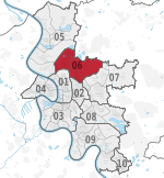
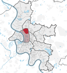
Mörsenbroich is an urban borough of Düsseldorf. It borders on Unterrath, Rath, Derendorf, Grafenberg and Düsselthal. Mörsenbroich has about 14,000 inhabitants. In the region around Düsseldorf is the "Mörsenbroicher Ei" ("Mörsenbroich egg") well-known, because there is large traffic-jam every morning. The Mörsenbroich egg is a place, where the federal highway A 52 ends and the traffic goes into the city of Düsseldorf. It crosses the federal road B 7 and two main roads of Düsseldorf, one of them is the ring road going along outside the central district of Düsseldorf. This article is based on a translation of an article from the German Wikipedia.
Excerpt from the Wikipedia article Düsseldorf-Mörsenbroich (License: CC BY-SA 3.0, Authors, Images).Düsseldorf-Mörsenbroich
Sankt-Franziskus-Straße, Dusseldorf Mörsenbroich (Stadtbezirk 6)
Geographical coordinates (GPS) Address Nearby Places Show on map
Geographical coordinates (GPS)
| Latitude | Longitude |
|---|---|
| N 51.255277777778 ° | E 6.8080555555556 ° |
Address
Sankt-Franziskus-Straße 98
40470 Dusseldorf, Mörsenbroich (Stadtbezirk 6)
North Rhine-Westphalia, Germany
Open on Google Maps


