place

Congressional Cemetery
1807 establishments in the United StatesBenjamin Henry Latrobe buildings and structuresBurials at the Congressional CemeteryCemeteries in Washington, D.C.Cemeteries on the National Register of Historic Places in Washington, D.C.
Historic American Buildings Survey in Washington, D.C.Historic American Landscapes Survey in Washington, D.C.National Historic Landmarks in Washington, D.C.United States national cemeteries
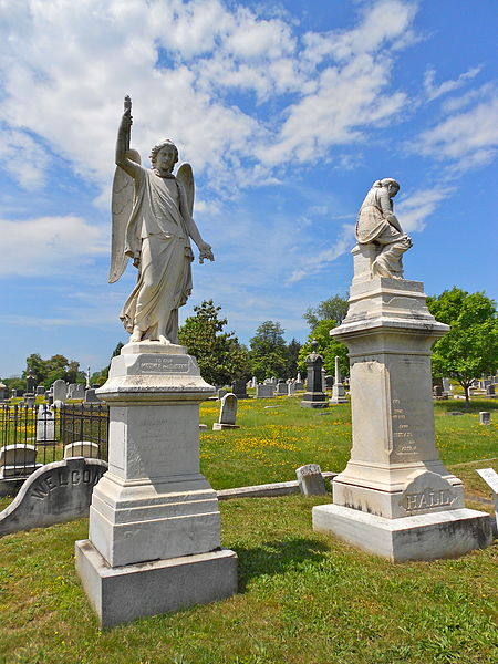
Liz and Mary Hall CC

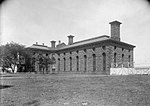
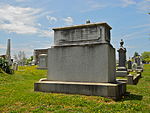
The Congressional Cemetery, officially Washington Parish Burial Ground, is a historic and active cemetery located at 1801 E Street, SE, in Washington, D.C., on the west bank of the Anacostia River. It is the only American "cemetery of national memory" founded before the Civil War. Over 65,000 individuals are buried or memorialized at the cemetery, including many who helped form the nation and the city of Washington in the early 19th century.Although the Episcopal Christ Church, Washington Parish owns the cemetery, the U.S. government has purchased 806 burial plots, which are administered by the Department of Veterans Affairs. Congress, located about a mile and a half (2.4 km) to the northwest, has greatly influenced the history of the cemetery. The cemetery still sells plots, and is an active burial ground. From the Washington Metro, the cemetery lies three blocks east of the Potomac Avenue station and two blocks south of the Stadium-Armory station. Many members of the U.S. Congress who died while Congress was in session are interred at Congressional Cemetery. Other burials include early landowners and speculators, the builders and architects of early Washington, Native American diplomats, Washington city mayors, and American Civil War veterans. Nineteenth-century Washington, D.C., families unaffiliated with the federal government also have graves and tombs at the cemetery. In all, there are one vice president, one Supreme Court justice, six Cabinet members, nineteen senators and seventy-one representatives (including a former speaker of the House) buried there, as well as veterans of every American war, and the first director of the Federal Bureau of Investigation, J. Edgar Hoover. The cemetery was listed on the National Register of Historic Places on June 23, 1969, and designated a National Historic Landmark in 2011.

Excerpt from the Wikipedia article Congressional Cemetery (License: CC BY-SA 3.0, Authors, Images).

Congressional Cemetery
Ingle Street, Washington

Geographical coordinates (GPS) Address Nearby Places
placeShow on map

Wikipedia: Congressional CemeteryContinue reading on Wikipedia

Geographical coordinates (GPS)

Latitude Longitude
N 38.881388888889 ° E -76.977777777778 °
placeShow on map

Address

Captain Erskine M. Camp

Ingle Street
20003 Washington
District of Columbia, United States
mapOpen on Google Maps

Liz and Mary Hall CC
Share experience

Nearby Places

Eastern Methodist Cemetery

Eastern Methodist Cemetery, also known as Old Ebenezer Cemetery and Ebenezer Cemetery, was a 4-acre (16,000 m2) cemetery located in the Barney Circle neighborhood of Washington, D.C., in the United States. It was founded in 1824 as a privately owned Methodist cemetery open to the public. (The earliest interment at Eastern Methodist came before the cemetery was incorporated. That was Ely Drown, who was buried there on August 18, 1823.) Its owner was the Fourth Street Methodist Church at Ebenezer Station (hence the nickname "Ebenezer Cemetery"). The cemetery was located one a city block bounded by D, E, 17th, and 18th Streets NE. It was across the street from and north of Congressional Cemetery. The cemetery was designed to hold 1,830 burial plots. But because of the cemetery's popularity, there were multiple burials in each grave, and by the 1890s the cemetery held more than 3,000 bodies.During the roughly 70 years in which the cemetery was in operation, many of the leading citizens of the Barney Circle, Capitol Hill, Kingman Park, and Atlas District were buried at Eastern Methodist Cemetery. The cemetery was never in good financial condition, however. The price of burial plots was too low to permit the cemetery to establish a perpetual care fund.Eastern Methodist Cemetery was built on marshy ground, however, and it was not very suitable as a burial ground. About 1890, the cemetery's trustees proposed closing the cemetery. To finance the disinterral of remains, the cemetery would be subdivided and sold for building lots. Lotholders, however, rejected the proposal. The trustees then sought a legal solution. In 1891, Congress enacted legislation allowing Eastern Methodist Cemetery to remove all bodies in the cemetery and subdivide and sell the land to finance their reinterrment elsewhere. Some remains were claimed by family members. The Fourth Street Methodist Church agreed to disinter and box these remains, and reinter them at church expense at whatever local cemetery the family chose. Remains which went unclaimed were interred in mass graves at Congressional Cemetery. Although there initially was opposition among lotholders against the cemetery's closure, no lawsuit emerged.Disinterrals commenced at the cemetery on October 1, 1892. By October 4, about 50 bodies had been removed from Eastern Methodist Cemetery, and cemetery officials were predicting that the cemetery would be cleared by the end of the year. Cemetery officials said that they had located nearly every grave listed in the cemetery's lotbook, and full clearance of bodies from the grounds was almost certain. As of November 3, about 1,000 bodies remained to be unearthed, but officials said they were sure to have the work finished within three more weeks.

John Philip Sousa Bridge

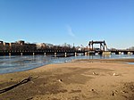
The John Philip Sousa Bridge, also known as the Sousa Bridge and the Pennsylvania Avenue Bridge, is a continuous steel plate girder bridge that carries Pennsylvania Avenue SE across the Anacostia River in Washington, D.C., in the United States. The bridge is named for famous United States Marine Band conductor and composer John Philip Sousa, who grew up near the bridge's northwestern terminus. The first bridge at this location was constructed in 1804, but burned by United States armed forces in 1814 during the War of 1812. It was replaced in 1815, but the bridge burned to the waterline in 1846. The rapid growth of residential developments east of the Anacostia River led to the construction of a narrow, iron girder bridge in 1890. This bridge led to even swifter economic and residential development of the area. Efforts to replace the 1890 bridge with a modern structure began in 1931, but were not successful until 1938. The downstream (southern) span opened on December 9, 1939, to great fanfare. The upstream span was completed in December 1940 and opened on January 18, 1941. The Sousa Bridge has a partial interchange with the Barney Circle traffic circle at its northwestern end, and a partial interchange with Anacostia Freeway at its southeastern terminus. A major battle over building an Inner Loop Expressway in the District of Columbia occurred in the 1950s and 1960s. This led to the partial construction of Interstate 695 from Interstate 395 to Barney Circle, but political battles over the wisdom of further construction led to cancellation of the remaining highway—leaving Barney Circle and the northern approaches to the Sousa Bridge partially deconstructed. An attempt to build the remainder of Interstate 695 (the "Barney Circle Freeway") in the 1990s also failed. In 2010, the District of Columbia decommissioned the portion of Interstate 695 leading to Barney Circle and the Sousa Bridge, and began rebuilding the circle and approaches.