place

Battery Rodgers

1863 establishments in VirginiaAmerican Civil War stubsBuildings and structures in Alexandria, VirginiaCivil War defenses of Washington, D.C.Forts in the District of Columbia
Battery Rodgers
Battery Rodgers

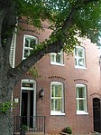
Battery Rodgers was a gun emplacement that composed a portion of the American Civil War defenses of the American capital city of Washington, D.C.

Excerpt from the Wikipedia article Battery Rodgers (License: CC BY-SA 3.0, Authors, Images).

Battery Rodgers
South Lee Street, Alexandria

Geographical coordinates (GPS) Address Nearby Places
placeShow on map

Wikipedia: Battery RodgersContinue reading on Wikipedia

Geographical coordinates (GPS)

Latitude Longitude
N 38.795166666667 ° E -77.0433 °
placeShow on map

Address

South Lee Street 832
22314 Alexandria
Virginia, United States
mapOpen on Google Maps

Battery Rodgers
Battery Rodgers
Share experience

Nearby Places

Jones Point Light
Jones Point Light

The Jones Point Light is a small river lighthouse located on the Potomac River in Alexandria, Virginia. It was built in 1855. It is a small, one-story house with a lantern on top and served primarily as a warning light for naval ships approaching the Washington Navy Yard. The lighthouse was discontinued in 1926, replaced by a small steel skeletal tower located nearby; this smaller tower was in use for ten years before being discontinued. After being dark for more than half a century, Jones Point Light was relit by a private concern in 1995, however, it was eventually put out again after ownership switched from the Daughters of the American Revolution Foundation to the National Park Service. Certain local efforts have called for the structure to be relit, but as of 2017, the only working lighthouse on the Potomac River is the Fort Washington Point Lighthouse, located five miles downriver. The lighthouse is located on Jones Point in Alexandria, and is part of Jones Point Park. Visitors can approach the lighthouse, but it is currently impossible to enter the building. The lighthouse is immediately north of the confluence of Hunting Creek and the Potomac River. The 1791-1792 survey of the boundaries of the District of Columbia began at a spot that was then at the tip of a cape at the Point. The south cornerstone from the boundary survey remains in the seawall adjacent to the lighthouse. In 1980, the lighthouse and the cornerstone were listed in the National Register of Historic Places as reference #80000352. The lighthouse is also listed in the Library of Congress Historic American Buildings Survey as survey number VA-641. The listing shows lighthouse drawings and several black-and-white photos of the lighthouse prior to restoration.