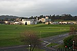
Murrayfield
Areas of EdinburghUse British English from July 2015

Murrayfield is an affluent area to the west of Edinburgh city centre in Scotland. It is to the east of Corstorphine and north of Balgreen and Roseburn. The A8 road runs east–west through the south of the area. Murrayfield is often considered to include the smaller neighbouring areas of Ravelston (to the north) and Roseburn (to the south).
Excerpt from the Wikipedia article Murrayfield (License: CC BY-SA 3.0, Authors, Images).Murrayfield
Murrayfield Road, City of Edinburgh Murrayfield
Geographical coordinates (GPS) Address Nearby Places Show on map
Geographical coordinates (GPS)
| Latitude | Longitude |
|---|---|
| N 55.946702777778 ° | E -3.2455972222222 ° |
Address
Murrayfield Road 9
EH12 6EL City of Edinburgh, Murrayfield
Scotland, United Kingdom
Open on Google Maps


