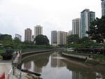
Queenstown, Singapore

Queenstown is a planning area and satellite residential town situated on the south-westernmost fringe of the Central Region of Singapore. It borders Bukit Timah to the north, Tanglin to the northeast, Bukit Merah to the east and southeast, as well as Clementi to the northwest and west. Its southern and southwesternmost limits are bounded by the Pandan Strait.Developed by the Singapore Improvement Trust in the 1950s and subsequently by the Housing and Development Board in the 1960s, Queenstown was the first satellite town to be built in the country. Most apartments within the township consists of simple one, two, or three-room flats, typically in low-rise, walk-up blocks. Major development work was carried out during the first Five-Year Building Programme between 1960 and 1965. A total of 19,372 dwelling units were constructed between 1952 and 1968.The headquarters of Grab, Razer and the Asia-Pacific Economic Cooperation (APEC) are located in Queenstown.
Excerpt from the Wikipedia article Queenstown, Singapore (License: CC BY-SA 3.0, Authors, Images).Queenstown, Singapore
Ayer Rajah Expressway,
Geographical coordinates (GPS) Address Nearby Places Show on map
Geographical coordinates (GPS)
| Latitude | Longitude |
|---|---|
| N 1.2941666666667 ° | E 103.78612777778 ° |
Address
Buona Vista Flyover
Ayer Rajah Expressway
139950 , Queenstown
Singapore
Open on Google Maps


