place

Isterberg

All accuracy disputesCounty of Bentheim (district)Municipalities in Lower Saxony
Isterberg in NOH
Isterberg in NOH

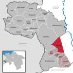
The community of Isterberg, in Lower Saxony’s district of Grafschaft Bentheim, came into being in the 1970s, through the amalgamation of the two former communities of Wengsel and Neerlage. It lies between Bad Bentheim and Nordhorn, and is part of the Samtgemeinde ("joint community") of Schüttorf (whose administrative seat is in the like-named town). There is no actual village centre. The namesake hill, the Isterberg -- with an elevation of 68 m -- is one of the last outliers of the Teutoburg Forest. There is a local YMCA (CVJM Isterberg-Quendorf), which serves not only the youth, but also adults and older citizen, as a meeting point. The Landjugend (“Rural Youth”) is also established in the community; among other activities, it organizes a yearly tent festival that is well-known throughout the former County of Bentheim. This small community also has its own volunteer fire brigade, which receives wide participation. The farthest outlying portion of the Teutoburg Forest is not to be found right at the Isterberg, but rather in Bad Bentheim‘s outlying centre at the center of Gildehaus. On the way out of that centre, on Gronauer Str., going towards the Netherlands, the forest’s last trees stand. It is supposed, however, that the Teutoburg Forest once stretched all the way to the Fürstlicher Busch (Princely Bush), which lies in the farming community of Bardel. Isterberg also has a no-fee outdoor swimming pool.

Excerpt from the Wikipedia article Isterberg (License: CC BY-SA 3.0, Authors, Images).

Isterberg
Am Südhang, Samtgemeinde Schüttorf

Geographical coordinates (GPS) Address Nearby Places
placeShow on map

Wikipedia: IsterbergContinue reading on Wikipedia

Geographical coordinates (GPS)

Latitude Longitude
N 52.348888888889 ° E 7.1463888888889 °
placeShow on map

Address

Am Südhang

Am Südhang
48465 Samtgemeinde Schüttorf
Lower Saxony, Germany
mapOpen on Google Maps

Isterberg in NOH
Isterberg in NOH
Share experience

Nearby Places

RAF Nordhorn
RAF Nordhorn

Royal Air Force Nordhorn, more commonly known as RAF Nordhorn, is a military aviation bombing and gunnery range to the east of nearby Nordhorn, in Lower Saxony, Germany. The range is used by the British Royal Air Force (RAF), the German Luftwaffe, and other NATO air forces and aviation arms of their other branches (such as the Army Air Corps, and the Fleet Air Arm). For decades it was part of RAF Germany. The first use for gunnery purposes was by the Wehrmacht in 1933, when the heaths to the east of the town of Nordhorn were used for artillery target practice. The RAF took over the range in 1945. The station played host to several Polish units, No. 302 Polish Fighter Squadron, No. 308 Polish Fighter Squadron, No. 317 Polish Fighter Squadron, and No. 662 Squadron RAF for short periods in April 1945. Also resident for a time was No. 131 Wing RAF, the First Polish Fighter Wing. During the Cold War, the daily flights over the town of Nordhorn were a constant reminder to the local townspeople of the ongoing struggle with the Soviets, despite the great distance to the border with communist East Germany. Despite the fall of the Berlin Wall in 1989, the base remained as one of the few military facilities used by British Armed Forces in Germany. In 1996, as British forces were withdrawn from the rest of Germany, the Nordhorn aerodrome was expanded. Also in 1996, the UK Ministry of Defence decided to hand control of the base to the German government within a timeframe of ten years. It was transferred back to the German Bundeswehr in March 2001. Despite being under German ownership, the RAF still maintains a presence at the base.