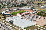
Mount Maunganui

Mount Maunganui (Māori pronunciation: [ˈmaʉŋaˌnʉi], locally ) is a major residential, commercial and industrial suburb of Tauranga located on a peninsula to the north-east of Tauranga's city centre. It was an independent town from Tauranga until the completion of the Tauranga Harbour Bridge in 1988, which connects Mount Maunganui to Tauranga's central business district. Mount Maunganui is also the name of the large lava dome which was formed by the upwelling of rhyolite lava about two to three million years ago. It is officially known by its Māori name Mauao, but is colloquially known in New Zealand simply as The Mount.The New Zealand Ministry for Culture and Heritage gives a translation of "large mountain" for Maunganui.
Excerpt from the Wikipedia article Mount Maunganui (License: CC BY-SA 3.0, Authors, Images).Mount Maunganui
Surf Road, Tauranga Mount Maunganui
Geographical coordinates (GPS) Address Nearby Places Show on map
 Continue reading on Wikipedia
 Geographical coordinates (GPS)
| Latitude | Longitude |
|---|---|
| N -37.659757 ° | E 176.214844 ° |
Address
Surf Road 3A
3116 Tauranga, Mount Maunganui
Bay of Plenty, New Zealand
Open on Google Maps