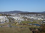
Ginninderra

Ginninderra is the name of the former agricultural lands surrendered to urban development on the western and north-western fringes of Canberra, the capital of Australia. Ginninderra corresponds with the watershed of Ginninderra Creek, which is now in part occupied by the Canberra districts of Belconnen and Gungahlin. The word 'Ginninderra' is one of several - Molonglo, Gold Creek and Monaro are others - that hold longstanding connections to Canberra's local history. The Ginninderra Cricket Club, Ginninderra District High School and Ginninderra Labor Club are examples. One of the local ACT electorates is called Ginninderra. The name is celebrated through the place name Ginninderra Drive, an arterial road that traverses the Canberra district of Belconnen.
Excerpt from the Wikipedia article Ginninderra (License: CC BY-SA 3.0, Authors, Images).Ginninderra
Barton Highway,
Geographical coordinates (GPS) Address Nearby Places Show on map
Geographical coordinates (GPS)
| Latitude | Longitude |
|---|---|
| N -35.193055555556 ° | E 149.08527777778 ° |
Address
Barton Highway
Barton Highway
2913 , Nicholls
Australia
Open on Google Maps


