place

Portuguese Bend

Geography of Los Angeles County, CaliforniaGeology of CaliforniaLandslides in the United StatesPalos Verdes PeninsulaPortuguese-American culture in California
Use mdy dates from March 2023
Portuguese Bend Landslide and Nature Preserve, Rancho Palos Verdes, California

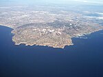
The Portuguese Bend region is the largest area of natural vegetation remaining on the Palos Verdes Peninsula, in Los Angeles County, California. Though once slated for development including the projected route of Crenshaw Boulevard, the area is geologically unstable and is unsuitable for building.

Excerpt from the Wikipedia article Portuguese Bend (License: CC BY-SA 3.0, Authors, Images).

Portuguese Bend
Fire Station Trail,

Geographical coordinates (GPS) Address Website Nearby Places
placeShow on map

Wikipedia: Portuguese BendContinue reading on Wikipedia

Geographical coordinates (GPS)

Latitude Longitude
N 33.74832 ° E -118.36061 °
placeShow on map

Address

Portuguese Bend Reserve

Fire Station Trail
90275 , Rolling Hills
California, United States
mapOpen on Google Maps

Website
pvplc.org

linkVisit website

Portuguese Bend Landslide and Nature Preserve, Rancho Palos Verdes, California
Share experience

Nearby Places

Old Whaling Station
Old Whaling Station

The Old Whaling Station or Old Whaling Station Portuguese Bend was a whaling station in California, built in 1869. The Old Whaling Station was designated a California Historic Landmark (No.381) on Jan. 3, 1944. The Old Whaling Station at Portuguese Bend was located in what is now Portuguese Bend in Rancho Palos Verdes, California in Los Angeles County.Portuguese Captain Frank Anderson processed 2,166 barrels of whale oil at this Historic Landmark from 1874 to 1877. In 1877 the station was abandoned. The whale stations had large kettles for rendering whale blubber into Whale oil, called tryworks. California's migrating whales were hunted in small boats from the station. Gray whales, as large as 36 tonnes, was the normal target. Hunting Gray whales in small boats was a very dangerous occupation, as many hunters were killed or injured. John Brown Whaling Company also operated at Portuguese Bend, starting in 1869. The last hunt was in 1885 due to the lack of the over hunted whales. Captain Joseph Clark is believed to have started the whaling industry in 1864. Gray whales were given protection from commercial hunting in 1949 by the International Whaling Commission (IWC) and are no longer hunted on a large scale.Los Angeles had a real estate boom in 1887. At this time Portuguese Bend was studied to see if a harbor could feasibly be built there. Pioneers of Orange County, J.K. Tuffree "Colonel John Tuffree" (1842–1903) made plans for a harbor, town, and railroad service to Portuguese Bend. He gave the planned harbor the name “Port Carolina,” after his wife Carolina (Polhemus)Tuffree. The real estate boom ended before he could start building.

Chowigna, California

Chowigna (also, Unaungna) is a former Tongva-Gabrieleño Native American settlement in Los Angeles County, California.It was located in modern-day Palos Verdes, Palos Verdes Peninsula.Name variations include: Chowiinga, Chowi, Unaungna, Chowigna, and Chowingna (near San Pedro).The Chowigna Village site at Malaga Cove has been inhabited for at least 7,100 years. It was first described by the Cabrillo Expedition in 1542. It was excavated in 1936-37 by the Southwest Museum of the Native Americans and the University of Southern California. Among the thousands of artifacts retrieved were "arrowheads, mortars and pestles, scrapers and spoons made from abalone, beads and art objects, bone tools, shells," including olivella and giant keyhole limpet shells, "and bones from food animals like mussels and birds ... An estimated 150 people lived at the site in its last days, about 1775." "The site stratigraphy and material culture assemblage provided the central framework of early cultural chronological sequences for the region."Artifacts of the Chowigna Native Americans are held by the Southwest Museum of the Native Americans and the Redondo Beach Historical Museum.The Chowigna Natives used the site of today's Hopkins Wilderness Park, formerly Nike missile site LA-57 from 1956 to 1963, in Redondo Beach as a lookout place. The wetlands located at the site of today's AES power plant in Redondo Beach were a source of foods including halibut, lobster, and sea bass, and also of salt. In the 18th century, the Chowigna bartered salt from the old Redondo Salt Lake, "a spring-fed salt lake about 200 yards wide and 600 yards long situated about 200 yards from the ocean", with other tribes. Their village by the lake was called "Onoova-nga", or "Place of Salt." The Chowigna were relocated to missions in 1854, when Manuel Dominguez sold 215 acres of Rancho San Pedro, including the lake, to Henry Allanson and William Johnson for the Pacific Salt Works.The Chowigna rancheria was associated with the Mission San Gabriel Arcángel.