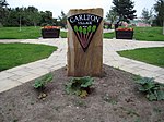
Robin Hood, West Yorkshire

Robin Hood is a village in the City of Leeds in West Yorkshire, England. It is close to the City of Wakefield boundary and is situated between Leeds and Wakefield as well as being close to Rothwell and Lofthouse. It forms part of the Ardsley and Robin Hood ward of Leeds City Council and the Morley and Outwood parliamentary constituency. The centre of Robin Hood is believed to be the Halfway House public house, situated at the main junction of the A61 and A654. The public house gained its name from its location being half-way between Leeds and Wakefield, located exactly 4 miles in either direction on the A61. It used to be known as "The Old Halfway House" and a public house or inn has been located on that site for centuries.
Excerpt from the Wikipedia article Robin Hood, West Yorkshire (License: CC BY-SA 3.0, Authors, Images).Robin Hood, West Yorkshire
Robertsgate, Wakefield
Geographical coordinates (GPS) Address Phone number Website Nearby Places Show on map
Geographical coordinates (GPS)
| Latitude | Longitude |
|---|---|
| N 53.73 ° | E -1.5 ° |
Address
Rodillian Academy
Robertsgate
WF3 3PS Wakefield
England, United Kingdom
Open on Google Maps


