place

Waterloo, Quebec

Cities and towns in QuebecIncorporated places in La Haute-Yamaska Regional County MunicipalityPages with non-numeric formatnum argumentsUse Canadian English from January 2023Waterloo, Quebec
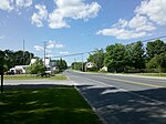
Waterloo, Québec (5788754288)

Waterloo (2021 population 4,920) is a city in the Canadian province of Quebec. It is included in La Haute-Yamaska Regional County Municipality, in the administrative area of Estrie. Completely encircled by the township of Shefford, this residential city is located within the Eastern Townships, about ninety kilometers east of Montreal.

Excerpt from the Wikipedia article Waterloo, Quebec (License: CC BY-SA 3.0, Authors, Images).

Waterloo, Quebec
Rue Foster,

Geographical coordinates (GPS) Address Nearby Places
placeShow on map

Wikipedia: Waterloo, QuebecContinue reading on Wikipedia

Geographical coordinates (GPS)

Latitude Longitude
N 45.35 ° E -72.516666666667 °
placeShow on map

Address

Rue Foster
J0E 2N0
Quebec, Canada
mapOpen on Google Maps

Waterloo, Québec (5788754288)
Share experience

Nearby Places

Shefford County, Quebec

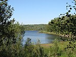
Shefford County is an historical county in southern Québec, Canada. It is named after Shefford, a small town in Bedfordshire county, England of the same name and is in the Eastern Townships region of Québec. Topographically, part of the county is situated on the western foothills of the Appalachian Mountains. The county contains four small lakes, Lake Waterloo near Waterloo, Lake Boivin in Granby Township, Lake Roxton in Roxton Township, and Lake Stukely in Stukely Township. All of the lakes flow into the Yamaska River, except for Lake Stukely which feeds into the St-François River, both of which flow northwards and are tributaries to the Saint Lawrence River. A prominent feature of the county is Mount Shefford in the Township of Shefford, one of a series of the Monteregian Hills that lie in a line between the Appalachian Mountains and the Saint Lawrence River. The county is shaped almost like a trapezoid. It is bounded in the south by Brome County (48 km; 45°17' N), in the north and northwest by Bagot County (35 km; 45°41' N), Richmond and Sherbrooke Counties in the east (35 km; 72°15' W) and in the west by Rouville County (34 km; 72°46' W). The county is divided into seven townships of which six are square-shaped, three in the north (from east to west, the Township of Ely, the Township of Roxton and the Township of Milton); and three in the south (from east to west, the Township of Stukely, the Township of Shefford and the Township of Granby). The Township of Upton is a strip of land located in the northwestern corner of the county and measures 1,25 km by 6,25 km. The county seat is Waterloo, located in the Township of Shefford. The best known town in the county is Granby, located in the township of the same name, known for its annual song and musical festival. Another well known town is Bromont, located in the southwestern corner of Shefford Township. The town has an IBM plant and was the site of the 1976 Summer Olympics equestrian events. In the early 1980s, Quebec abolished its counties, and Shefford County was divided and transferred to Acton Regional County Municipality (north), Les Maskoutains Regional County Municipality (northwest), La Haute-Yamaska Regional County Municipality (west), Brome-Missisquoi Regional County Municipality (southwest), Memphremagog Regional County Municipality (southeast), and Le Val-Saint-Francois Regional County Municipality (northeast).

Brome County, Quebec

Brome County, is a historical county of Quebec. It takes its name from the name of a manor in the parish of Barham in Kent, England that was named after the broom plant. It was named by English surveyors. The earliest settlers to this region were brought from New Hampshire by the Quaker leader, Nicholas Austin in the 1790s. The county was formed in 1855 from parts of Stanstead, Shefford and Missisquoi counties. The county is located in the Eastern Townships, one of the 12 regions of Quebec. The county lies in the foothills of the Appalachian Mountains. Its eastern half is rolling countryside while its western half is part of the Richelieu River plains. The county is roughly an upside-down "L" shape, bound on the south by the Canada–US border (along 45° for 17.5 km from 72° 15′ W in Lake Memphremagog to 72° 41.5′ W), in the east by in part Lake Memphremagog and Stanstead County, in the north by Shefford County (45° 20′ N for 48 km from 72° 15′ W to 72° 52′ W) and in the west by Rouville and Missisquoi counties. The county is divided into five townships, three in the north and two in the south. The townships in the north are, from east to west, the Township of Bolton, the Township of Brome and the Township of Farnham. The southern townships are the Township of Potton in the east and the Township of Sutton in the west. The county seat is Knowlton in the Township of Brome. Notable physical features of the county include Mount Brome in the northwestern corner of the Township of Brome and the much larger Mount Sutton in the Township of Sutton, and Brome Lake in the eastern part of the Township of Brome, which flows into the Yamaska River, site of a famous duck farm. Along Lake Memphremagog in the Township of Potton are three mountains, from north to south, Mount Sugar Loaf, the larger Mount Owl's Head, and Mount Bear. Owl's Head and Sutton are well-known ski hills. In the early 1980s the county was abolished and the western half was transferred to the new Regional County Municipality of Brome-Missisquoi and the eastern half was transferred to the Regional County Municipality of Memphrémagog. A small part in the northwest were transferred to the Regional County Municipality of La Haute-Yamaska.