Stockholm County

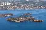
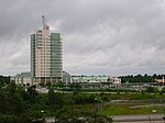
Stockholm County (Swedish: Stockholms län [ˈstɔ̂kː(h)ɔlms ˈlɛːn]) is a county or län (in Swedish) on the Baltic Sea coast of Sweden. It borders Uppsala County and Södermanland County. It also borders Mälaren and the Baltic Sea. The city of Stockholm is the capital of Sweden. Stockholm County is divided by the historic provinces of Uppland (Roslagen) and Södermanland (Södertörn). More than one fifth of the Swedish population lives in the county. Stockholm County is also one of the statistical riksområden (national areas) according to NUTS:SE, Nomenclature of Territorial Units for Statistics within the EU. With more than two million inhabitants, Stockholm is the most densely populated county of Sweden.
Excerpt from the Wikipedia article Stockholm County (License: CC BY-SA 3.0, Authors, Images).Stockholm County
Lidingö kommun
Geographical coordinates (GPS) Address Nearby Places Show on map
Geographical coordinates (GPS)
| Latitude | Longitude |
|---|---|
| N 59.333333333333 ° | E 18.166666666667 ° |
Address
Nysätra
181 60 Lidingö kommun, Skärsätra
Sweden
Open on Google Maps


