place

County Ground, Lakenham

Cricket grounds in NorfolkDefunct cricket grounds in EnglandEnglish cricket ground stubsNorfolk building and structure stubsSports venues in Norwich
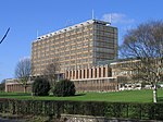
Former Norfolk County Cricket Ground geograph.org.uk 677696

The County Ground in Lakenham, Norwich, Norfolk was a cricket ground for over two hundred years, hosting both first-class and List A cricket. Five first-class games, all involving touring international sides, were played here between 1912 and 1986, and 13 List A matches were staged between 1969 and 1998. The County Ground's most regular users, however, were Norfolk County Cricket Club, who played over 400 Minor Counties Championship games at the venue. In the early 21st century the ground was redeveloped for a variety of other uses.

Excerpt from the Wikipedia article County Ground, Lakenham (License: CC BY-SA 3.0, Authors, Images).

County Ground, Lakenham
City Road, Norwich Lakenham

Geographical coordinates (GPS) Address Phone number Website Nearby Places
placeShow on map

Wikipedia: County Ground, LakenhamContinue reading on Wikipedia

Geographical coordinates (GPS)

Latitude Longitude
N 52.616094444444 ° E 1.3014638888889 °
placeShow on map

Address

Lakenham Primary School

City Road
NR1 2HL Norwich, Lakenham
England, United Kingdom
mapOpen on Google Maps

Phone number

call+441603877780

Website
lakenhamprimaryschool.co.uk

linkVisit website

Former Norfolk County Cricket Ground geograph.org.uk 677696
Share experience

Nearby Places

River Tas
River Tas

The River Tas is a river which flows northwards through South Norfolk in England - towards Norwich. The area is named the Tas Valley after the river. The name of the river is back-formed from the name of village of Tasburgh (E. Ekwall, English-River-names, p. 393). Tributaries which have their sources at Hempnall and Carleton Rode converge at Tasburgh. The river then flows on through Newton Flotman and Smockmill Common. In Shotesham Park the river splits into two channels which rejoin just above Shotesham ford. The pool here is a popular location in summer time for paddling, swimming and fishing. From Shotesham the river flows northwards through Stoke Holy Cross, Dunston, Caistor St Edmund, Markshall and Arminghall. It joins the River Yare at Trowse - just south of Norwich.The Tas valley contains many interesting historical sites including: an Iron Age hill fort at Tasburgh, the old Roman settlement of Venta Icenorum (now Caistor St Edmund) and the site of a woodhenge at Arminghall. The mill at Stoke Holy Cross was the first location of the Colman's mustard business. In Roman times the River Tas was considerably larger and provided a major transport route for the inhabitants of Venta Icenorum. Today it is a small river which winds through farmland. It contains roach, dace, occasional trout, small pike and some chub. One of the largest roach ever caught in the river was a 2.6 pound specimen landed by local angler Bill Coleman in 1972. The best dace was probably one of 1.2 pounds caught by W. Comer in 1943.

Dragon Hall, Norwich

Dragon Hall is a Grade-1 listed medieval merchant's trading hall located in King Street, Norwich, Norfolk, close to the River Wensum, and since 2018 home to the National Centre for Writing. It is thought to be unique in being the only such trading hall in Northern Europe to be owned by one man. The building stands on what was the main road through the city in the 15th century, with river transport links via Great Yarmouth to the Low Countries. Dragon Hall is now acknowledged as one of Norwich's medieval architectural gems and an iconic building in the city. The Great Hall on the first floor was built in the 15th century, but some parts of the site are older. Archaeological research shows evidence of an Anglo-Saxon hut c.1000 beneath the Hall. On the northern part of the site, in the late 13th century, the abbey at Woburn, Bedfordshire, had a fish processing operation with various outbuildings and a track to a staithe or quay. There was also a boundary wall with a large brick arch to give access to King Street. In about 1330 an L-shaped domestic 'hall house' owned by John Page was built on the southern part of the site with an undercroft and an entrance on the south side from Old Barge Yard. In about 1427 Robert Toppes, a Norwich merchant, re-developed the site as a commercial complex. He built his first floor trading hall on top of part of the 14th century domestic hall house and on top of the existing boundary wall and brick arch. He retained the 14th century entrance to the hall house for his customers. From the entrance passage his customers went up a new staircase to the first floor trading hall. This was a timber construction of seven bays with a crown post roof, decorated with carvings in the spandrels of 14 dragons. The hall was constructed with English oak, using some 1,000 trees. At the rear of the building he created a yard space with access to the river for his imports and exports, a warehouse area under the hall and a new stairway down to the extended undercroft from the yard. Part of the hall house was retained as a ground floor reception area.