Devínska Kobyla

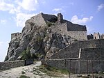
Devínska Kobyla (Slovak pronunciation: [ˈɟeʋiːnska ˈkɔbila]; Hungarian: Dévényi-tető; German: Thebener Kogel) is the highest peak in the Devín Carpathians, part of the Little Carpathians mountain range, and the highest point of Bratislava, the capital of Slovakia. It is located between the boroughs of Devínska Nová Ves, Devín and Dúbravka, close to the border with Austria. Its peak elevation is 514 m (1686.3 ft) AMSL and its treeless summit contains an abandoned military missile base (Slovak: Rádiotechnická hláska protivzdušnej obrany štátu) that is officially inaccessible to the public. Part of southern slopes of the massif has been a national natural reserve since 1965, featuring unique xerothermic forest-steppe flora and fauna with a total protected area of 101 hectares. From the flat top, a view opens of Bratislava, Austria, Hungary, the Danube and the Morava river. Hiking trails do not lead to the summit but instead to an accessible point with partial view underneath.
Excerpt from the Wikipedia article Devínska Kobyla (License: CC BY-SA 3.0, Authors, Images).Devínska Kobyla
Vápenka, Bratislava
Geographical coordinates (GPS) Address Nearby Places Show on map
Geographical coordinates (GPS)
| Latitude | Longitude |
|---|---|
| N 48.190555555556 ° | E 16.995833333333 ° |
Address
Vápenka
841 07 Bratislava (District of Bratislava IV)
Region of Bratislava, Slovakia
Open on Google Maps


