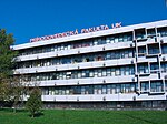
Sihoť

Sihoť is the largest river island on the Danube in Bratislava, the capital of Slovakia, located in the district of Karlova Ves. The island lies between the main flow of the Danube to the north and the parallel channel Karloveské rameno to the south, between Devínska cesta in Bratislava and the Austrian border. It contains a culturally protected water source supplying tap water to a large portion of Bratislava citizens, as well as numerous nearby villages. Under communism, access to the island was restricted due to its proximity to the Austrian border and the only access bridge to the island was guarded by soldiers. Access to the island remained forbidden even after the end of communism and today, access is highly restricted. Since 15 May 2012, the island is a protected area and there is currently an initiative to declare the island a national park and connect it with the neighboring Danube-Auen National Park in Austria.
Excerpt from the Wikipedia article Sihoť (License: CC BY-SA 3.0, Authors, Images).Sihoť
Devínska cesta, Bratislava
Geographical coordinates (GPS) Address Nearby Places Show on map
Geographical coordinates (GPS)
| Latitude | Longitude |
|---|---|
| N 48.1467 ° | E 17.0408 ° |
Address
Vodárenská studňa č. 1
Devínska cesta
841 04 Bratislava (District of Bratislava IV)
Region of Bratislava, Slovakia
Open on Google Maps


