place

Knott End-on-Sea

Geography of the Borough of WyreLancashire geography stubsMorecambe BayPopulated coastal places in LancashireThe Fylde
Use British English from April 2015Villages in Lancashire
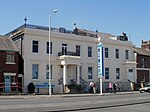
Knott End Methodist Church geograph.org.uk 1758574

Knott End-on-Sea is a village in Lancashire, England, on the southern side of Morecambe Bay, across the Wyre estuary from Fleetwood. Knott End has a pub, the Bourne Arms, county library and golf club. Buses run regularly from Knott End and there is also a three-minute ferry crossing to Fleetwood. Knott End also has two clubs, The Squash and Knott End Working Men's Club.

Excerpt from the Wikipedia article Knott End-on-Sea (License: CC BY-SA 3.0, Authors, Images).

Knott End-on-Sea
Lancaster Road, Borough of Wyre Preesall

Geographical coordinates (GPS) Address Nearby Places
placeShow on map

Wikipedia: Knott End-on-SeaContinue reading on Wikipedia

Geographical coordinates (GPS)

Latitude Longitude
N 53.926 ° E -2.979 °
placeShow on map

Address

Lancaster Road

Lancaster Road
FY6 0DX Borough of Wyre, Preesall
England, United Kingdom
mapOpen on Google Maps

Knott End Methodist Church geograph.org.uk 1758574
Share experience

Nearby Places

Pharos Lighthouse, Fleetwood

The Pharos Lighthouse (also known as the Upper Lighthouse) is a 93-foot (28 m) tall Runcorn red sandstone lighthouse situated in Fleetwood, Lancashire, England. The lighthouse was designed in 1839 by Decimus Burton and Capt H.M. Denham. Burton has been commissioned three years previously by Sir Peter Hesketh Fleetwood as the architect of the new town of Fleetwood. Construction was completed in 1840. Unusually for a functioning British lighthouse, it stands in the middle of a residential street (Pharos Street). Though officially named the 'Upper Lighthouse', it has been known as the 'Pharos' since its construction, after the celebrated ancient lighthouse Pharos of Alexandria. The lighthouse was designed and constructed in conjunction with the much shorter (34 feet (10 m)) Lower Lighthouse (also known as Beach Lighthouse) which stands on Fleetwood sea front. The lighthouses are designed to be used as a pair to guide shipping through the treacherous sandbanks of the Wyre estuary. The light from the Pharos should be kept immediately above the light from the Lower for safe passage down the channel. Both lighthouses were first illuminated on 1 December 1840. Each was run off the town's gas supply, with a single parabolic reflector placed behind the burner; later they were converted to electricity. The lamp is approximately 104 feet (32 m) above sea level, giving a range of about 12 nautical miles (22 km). For many years, the lighthouse was painted a striking cream and red colour, but in the late 1970s, the original sandstone was again exposed. The Fleetwood terminal loop of the Blackpool tramway runs past the foot of the lighthouse. The lighthouse is managed by the Port of Fleetwood. The interior is closed to the general public.