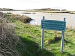
Christchurch Airfield
Airports in South West EnglandBuildings and structures in Christchurch, DorsetDefunct airports in EnglandHistory of Christchurch, DorsetTransport in Dorset ... and 1 more
Use British English from May 2013
For the World War II use of this facility, see RAF ChristchurchChristchurch Airfield was located southeast of the A337/B3059 intersection in Somerford, Christchurch, Dorset, England. It was a civil airfield starting from 1926, then it was used during World War II by the Royal Air Force and the United States Army Air Forces Ninth Air Force. After the war the airfield returned to civilian use and the airfield complex was then demolished in 1966.
Excerpt from the Wikipedia article Christchurch Airfield (License: CC BY-SA 3.0, Authors).Christchurch Airfield
Airfield Road,
Geographical coordinates (GPS) Address Nearby Places Show on map
Geographical coordinates (GPS)
| Latitude | Longitude |
|---|---|
| N 50.73546 ° | E -1.74541 ° |
Address
Airfield Road
Airfield Road
BH23 3TQ , Somerford
England, United Kingdom
Open on Google Maps


