Etherdwick
East Riding of Yorkshire geography stubsHoldernessOpenDomesdayUse British English from November 2014Villages in the East Riding of Yorkshire

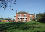
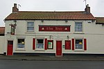
Etherdwick is a hamlet in the East Riding of Yorkshire, England in an area known as Holderness. It is approximately 9 miles (14 km) north-west of Withernsea town centre. It lies 1.5 miles (2.4 km) to the west of the B1242 road. The hamlet forms part of the civil parish of Aldbrough. In 1823 Bulmer's Topography, History and Directory of East Yorkshire wrote Etherdwick's name as "Etherdwicke". At the time it was in the Wapentake and Liberty of Holderness. Recorded in the hamlet were three farmers.
Excerpt from the Wikipedia article Etherdwick (License: CC BY-SA 3.0, Authors, Images).Etherdwick
Hull Road,
Geographical coordinates (GPS) Address Nearby Places Show on map
Geographical coordinates (GPS)
| Latitude | Longitude |
|---|---|
| N 53.816568 ° | E -0.129325 ° |
Address
Hull Road
Hull Road
HU11 4RF , Aldbrough
England, United Kingdom
Open on Google Maps


