place

Manalapan, Florida

Beaches of FloridaBeaches of Palm Beach County, FloridaPopulated coastal places in Florida on the Atlantic OceanTowns in FloridaTowns in Palm Beach County, Florida
Use mdy dates from June 2018
Map of Florida highlighting Manalapan

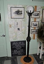
Manalapan is a town in Palm Beach County, Florida, United States. The population was 406 at the 2010 United States census.

Excerpt from the Wikipedia article Manalapan, Florida (License: CC BY-SA 3.0, Authors, Images).

Manalapan, Florida
Little Pond Road,

Geographical coordinates (GPS) Address Nearby Places
placeShow on map

Wikipedia: Manalapan, FloridaContinue reading on Wikipedia

Geographical coordinates (GPS)

Latitude Longitude
N 26.570833333333 ° E -80.044444444444 °
placeShow on map

Address

Little Pond Road 15
33462
Florida, United States
mapOpen on Google Maps

Map of Florida highlighting Manalapan
Share experience

Nearby Places

Lofthus (shipwreck)
Lofthus (shipwreck)

The Lofthus (also known as the Cashmere) is a Norwegian shipwreck (which sank in 1898) near Boynton Beach, Florida, United States. Built in 1868 in Sunderland, England by T.R. Oswald, the 222-foot iron-hulled vessel was originally christened Cashmere and rigged as a three masted barque. She was painted with false gunports to ward off Sumatran and Javanese pirates. After a career in the East Indian trade Cashmere was sold to a Norwegian firm, renamed Lofthus, and used in the American trade. On February 4, 1898, the Lofthaus wrecked in a storm en route to Buenos Aires, Argentina from Pensacola, Florida. The crew of 16 men, as well as the ship's cat and dog were rescued by the passing vessel Three Friends, which was smuggling guns to Cuba. The ship, however, was declared a loss as it could not be removed from the shallow reef. The cargo, primarily lumber, was salvaged and brought ashore by locals and reportedly used to build homes in the Boynton Beach area.The wreck of the Lofthus is located approximately three-quarters of a mile north of the Boynton Inlet and 175 yards offshore from Manalapan. According to the National Park Service, the remnants of the ship rest in 15 to 20 feet of water, with “wreckage rising as much as six feet off the sea floor depending on sand movement.” This often means large sections of the wreck may be entirely covered or completely exposed contingent on waves, currents, and storm conditions. After salvagers dynamited the hull, the wreck site became scattered across an area approximately 290 feet long by 50 feet wide, with the bow, midships, and stern separated into three distinct areas. The wreck is also now home to a number of native marine flora and fauna, including the Caribbean spiny lobster, cubbyu, grunts, jacks, porcupine fish, porkfish, snapper, stingrays, and wrasse.On January 6, 2004, it was added to the U.S. National Register of Historic Places and was officially designated as the eighth Florida Underwater Archaeological Preserve (and Palm Beach County's first) during a ceremony at Boynton Beach Intracoastal Park. During the ceremony, former Historical Society of Palm Beach County president, Harvey Oyer, presented a brief history of the ship and the wreck. According to the historical society, Oyer's great-great grandparents were “among the first to board the grounded ship and help salvage its cargo before it sank.”

Lake Osborne

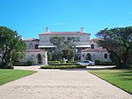
Lake Osborne, Florida, USA is a 378-acre (152.9 hectares) lake that is part of a system of once natural freshwater lakes lying along the western slope of the coastal ridge in Palm Beach County just west of the Florida Intracoastal Waterway and Atlantic Ocean. It is located within the C-16 drainage basin which occupies approximately 40,031 acres of land (16,200 hectares). Five drainage canals discharge directly to Lake Osborne, and Lake Osborne discharges via the E-4 canal to the C16 and C51 canals to the Lake Worth Lagoon. The lake is bordered on the west by John Prince Memorial Park, and on the east be the City of Lake Worth. This lake system has been greatly impacted from human activities. It has been extensively modified and reduced in size by dredge and fill activities from urban and residential development; several lakes were completely filled and built upon. The lakes were probably dredged contemporaneous with canal construction in the 1920s or earlier. It is likely that filling of the adjacent wetlands for residential construction occurred at the same time or later. Square Lake and its oxbow lake were dredged for fill in the 1960s and additional dredging occurred in the north lobe of Lake Osborne in the 1970s. Degradation of the lake's water quality has been ongoing; however, with the elimination of domestic waste discharges 20+ years ago, the water quality has shown improvement. Eutrophication continues as a result of continued discharges of stormwater and agricultural and yard/street runoff. More than two dozen stormwater outfalls are situated within 1000 ft of Lake Osborne. In addition to the lake's loss of habitat value due to urban and residential growth, there has been significant establishment of exotic vegetation, fish, and molluscan species that have disrupted the lake's ecosystem function. Lake Osborne is important to Palm Beach County for transporting, processing, and storing stormwater and serving as a water supply reservoir. It is also of considerable value to the county for its scenic value and the recreational opportunities it provides. It is heavily used for boating and fishing as well as a variety of shore-based activities. In addition, John Prince Park, located along the western shoreline of Lake Osborne's north and central lobe, offers an ecotourism destination for visitors seeking a natural experience where they can enjoy and learn about this ecosystem. Due to development, vegetated littoral areas in and adjacent to Lake Osborne have been reduced to a fragment of their original size. The lake shorelines predominantly consist of bare sand or mowed grass and exotic and/or invasive vegetation. John Prince Park maintains a lawn like appearance for the majority of the shorelines of Lake Osborne. Within the water column exotic vegetation, such as water lettuce (Pistia stratiotes), water hyacinth (Eichhornia crassipes), hydrilla (Hydrilla verticillata), and now Hygrophila (Hygrophila spp.), pose an ongoing nuisance and are treated with aquatic herbicides. With the loss of aquatic habitat, fish populations within the lake are becoming more represented by rough species, such as Tilapia (Tilapia sp. and Oreochromis sp.).