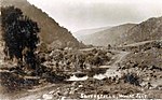
place

Lake Waipori

Clutha DistrictLakes of OtagoOtago geography stubsTaieri RiverWetlands of Otago
Waipori
Waipori

Lake Waipori is the smaller and shallower of the pair of lakes located in the wetlands to the south west of Dunedin in New Zealand on the Waipori River. The Waipori River is a major tributary of the Taieri River, and these wetlands form the southern edge of the Taieri Plains.The lake is inhabited by various waterfowl and wetland birds. It is however too shallow and inaccessible (due to being surrounded with wetlands) to allow for recreation other than fishing and duck hunting in season.It is possible to travel from the Waipori River at Berwick through the lake and through to Lake Waihola in a flat bottomed dinghy or jetboat. The lake is too shallow for other forms of motorboat.The lake is bordered to the southwest by the Sinclair Wetlands.

Excerpt from the Wikipedia article Lake Waipori (License: CC BY-SA 3.0, Authors, Images).

Geographical coordinates (GPS)

Latitude Longitude
N -45.966666666667 ° E 170.11666666667 °
placeShow on map

Address

Clutha District


Otago, New Zealand
mapOpen on Google Maps

Waipori
Waipori
Share experience

Nearby Places

Taieri Plain
Taieri Plain

The Taieri Plain (also referred to in the plural as the Taieri Plains) is an area of fertile agricultural land to the southwest of Dunedin, in Otago, New Zealand. The plain covers an area of some 300 square kilometres, with a maximum extent of 30 kilometres. It is not to be confused with Strath Taieri, a second plain of the Taieri River, 40kms to the north beyond Mount Ross. The floodplain of the Taieri and Waipori Rivers, the plain is enclosed to the west by Maungatua and the Silverpeaks Range, and to the south and east by a low range of coastal hills.Dairy and sheep farming dominate the agriculture of the plain, although deer farming is starting to have an economic impact. The alluvial nature of the land means that floods are not uncommon, especially in the area around the confluence of the two rivers. Stopbanks protect farmland, houses and Dunedin International Airport at Momona. State Highway 1 crosses parts of the plain along some of the stopbanks, with the result that this stretch of road is known locally as The "Floodfree" Highway.New Zealand's lowest point, at 2m below sea level, is slightly north of the airport on Kirk's Drain Road, Momona. To the northeast, the city of Dunedin is separated from the Taieri Plain by a range of rugged hills which are part of the crater of an extinct volcano. At the northeastern limit of the plain lies the town of Mosgiel, officially part of the city of Dunedin. Other settlements and towns on the plain include Outram, Henley, Allanton, and Momona. To the southwest, a short stretch of rolling hill country separates the Taieri Plain from South Otago's other main lowland areas around the Tokomairaro River and Clutha River. The twin lakes of Waihola and Waipori sit within these hills, as does the Sinclair Wetlands Reserve.

Outram, New Zealand
Outram, New Zealand

Outram is a rural suburb of Dunedin, New Zealand, with a population of 642 (2006 Census). It is located 28 kilometres west of the central city at the edge of the Taieri Plains, close to the foot of Maungatua. The Taieri River flows close to the southeast of the town. Outram lies on State Highway 87 between Mosgiel and Middlemarch. The original town was formed at a river crossing (ferry then bridge) on a route to the Central Otago goldfields. The village was moved following a flood in the late 19th century and relocated to its current location. It was the first town in New Zealand to have electric street lights and still has the town's library. From 1877 until 1953, Outram was served by a branch line railway that connected with the Main South Line. This line was known as the Outram Branch and it had a relatively unremarkable career. Closure came as a result of an almost total absence of traffic caused by the development of road transport during the first half of the 20th century, and today, few remnants of the line are visible. Outram's facilities include Outram Volunteer Fire Brigade, Outram Primary School, Outram Library, West Taieri Rugby Club, Church, Memorial Hall, Outram Hotel, a handful of retail outlets including a cafe and some antique shops. The West Taieri Cemetery is on the outskirts of the town. Outram is administered by Dunedin City Council, and has a reticulated water supply, but no reticulated sewerage. Sir John Richardson named the town after Sir James Outram, a British general in the Indian Rebellion of 1857.The town was the setting and filming location for New Zealand's first non-documentary "talkie" film, 1935's Down on the Farm. The 1982 movie Shaker Run features a brief scene shot in the main street of Outram.

Allanton, New Zealand

Allanton (Māori: Ōwhiro) is a small town in Otago, New Zealand, located some 20 kilometres southwest of Dunedin on State Highway 1. The settlement lies at the eastern edge of the Taieri Plains close to the Taieri River at the junction of the main road to Dunedin International Airport at Momona.Established near the junction of the Taieri River and Owhiro Stream the site was first known to Europeans as "Scroggs' Creek Landing" after Samuel Scroggs, a member of Charles Kettle's survey teams. The surrounding area was (and still is) known as Owhiro. In 1875, with the arrival of the railway south from Dunedin; and satisfying criteria for a "town", the community was renamed Greytown - after former Governor Sir George Grey. Among those who took up land in the growing community were immigrant Poles, from among the "Brogdenites" who had constructed the railway. Several Polish surnames survive in the local community. In 1895 a conflict of identity was recognised between the local community and another Greytown, well established in the Wairarapa. The Taieri County Council met and agreed to again rename the community. By a unanimous decision it was given the name "Allanton" - as a gesture of respect for the late James Allan of nearby "Hopehill", a former Otago Provincial Councillor, County Councillor and East Taieri Church Elder.Allanton's community has declined in recent years, with the local school closing in 2004 and the Sacred Heart Catholic Church closing the following year. The final shop to close was the 'Honey Shoppe', which closed in 2011.

Silver Stream
Silver Stream

The Silver Stream (Māori: Whakaehu) (sometimes written Silverstream) is a small river flowing close to the town of Mosgiel in Otago, New Zealand.The Silver Stream rises in the Silverpeaks hills north of Dunedin, on the southern slope of Silver Peak itself, and flows initially southwards through a steep-sided forested valley which widens to become Whare Flat, before turning west at the eastern edge of the Taieri Plains at the foot of Three Mile Hill, close to Invermay Research Station. It continues in a southwesterly direction past the northern edge of Mosgiel, reaching the Taieri River two kilometres north of Allanton. Its total length is about 30 kilometres (19 mi). Silver Stream is the site of a historic water race. The Silver Stream Water Race was built between 1877 and 1881, and consisted of nearly 30 kilometres (19 mi) of open races, sluices, tunnels, and weirs. The race began at a weir high on the river and traversed the sides of Swampy Summit and Flagstaff before emptying into a reservoir in Kaikorai Valley. Despite efforts to improve the race with the installation of a pump in 1920, it was not successful; problems with subsidence led to much of the race being enclosed in pipe, and the race was finally abandoned in the 1960s.The river's flow is generally small (at below one cumec), but it has a history of flooding. This has been largely remedied by the artificial raising of its banks, especially close to Mosgiel. In mid-2006, after heavy rain, the Silver Stream flooded at some points, but did not flood on the part of the bank running close to the town. Several walking routes are located close to or in the valley of the Silver Stream, most of which are aimed at more experienced trampers.Silverstream School and Silverstream Drive in Mosgiel are named for the river.