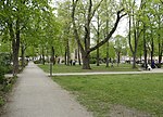
Tennenlohe
Erlangen

The village of Tennenlohe, is a local subdistrict and a statistical district in the southeast part of the independent city of Erlangen in the Bavarian administrative district of Middle Franconia. Until 1972, when it was incorporated, Tennenlohe was an independent municipality in the Erlangen county. The statistical district 52, which covers a large part of the Tennenlohe district, has about 4,400 inhabitants. The place is considered a village by the locals, however from a US- or Canadian perspective this might as well be considered a small town. In general, places that have a population of under 5,000 inhabitants are mostly considered to be a village in Germany.
Excerpt from the Wikipedia article Tennenlohe (License: CC BY-SA 3.0, Authors, Images).Tennenlohe
Steinweg, Erlangen
Geographical coordinates (GPS) Address Nearby Places Show on map
Geographical coordinates (GPS)
| Latitude | Longitude |
|---|---|
| N 49.551111111111 ° | E 11.028333333333 ° |
Address
Steinweg
Steinweg
91058 Erlangen
Bavaria, Germany
Open on Google Maps


