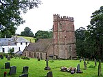
Combe Florey
Civil parishes in SomersetUse British English from August 2012Villages in Taunton Deane

Combe Florey is a village and civil parish in Somerset, England, situated 6 miles (9.7 km) northwest of Taunton, on the West Somerset Railway. The village has a population of 261. The parish includes the hamlet of Eastcombe which is a linear settlement along the A358 Taunton-Wiliton Road. The village public house is The Farmer's Arms.
Excerpt from the Wikipedia article Combe Florey (License: CC BY-SA 3.0, Authors, Images).Combe Florey
Williton Road,
Geographical coordinates (GPS) Address Nearby Places Show on map
Geographical coordinates (GPS)
| Latitude | Longitude |
|---|---|
| N 51.0765 ° | E -3.2075 ° |
Address
Williton Road
TA4 3HY
England, United Kingdom
Open on Google Maps


