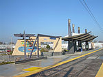
Parkway–South Sacramento, California
Former census-designated places in CaliforniaUnincorporated communities in CaliforniaUnincorporated communities in Sacramento County, California

Parkway–South Sacramento is a former census-designated place (CDP) in Sacramento County, California, United States. It is part of the Sacramento–Arden-Arcade–Roseville Metropolitan Statistical Area. The area shares three boundaries with the City of Sacramento. The population was 36,468 at the 2000 census. The CDP was abolished before the 2010 census. For that census, the area was divided into the CDPs of Fruitridge Pocket, Lemon Hill and Parkway.
Excerpt from the Wikipedia article Parkway–South Sacramento, California (License: CC BY-SA 3.0, Authors, Images).Parkway–South Sacramento, California
Leola Way,
Geographical coordinates (GPS) Address Nearby Places Show on map
Geographical coordinates (GPS)
| Latitude | Longitude |
|---|---|
| N 38.511666666667 ° | E -121.45222222222 ° |
Address
Leola Way 6312
95824
California, United States
Open on Google Maps


