place

Cape Cornwall

Headlands of CornwallNational Trust properties in CornwallPenwithSt Just in Penwith
Cape Cornwall
Cape Cornwall

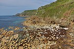
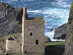
Cape Cornwall (Cornish: Kilgoodh, meaning "goose back") is a small headland in West Cornwall, England. It is 4 miles (6.4 km) north of Land's End near the town of St Just. Until the first Ordnance Survey in the early 19th-century, Cape Cornwall was believed to be the most westerly point in Cornwall.Most of the headland is owned by the National Trust. National Coastwatch has a look-out on the seaward side. The only tourist infrastructure at present is a car park (owned by the National Trust), public toilets, and a refreshments counter during the summer. The Brisons, two offshore rocks, are located approximately 1 mi (1.6 km) southwest of Cape Cornwall. They mark the starting line of the annual swimming race ending at Priest Cove.

Excerpt from the Wikipedia article Cape Cornwall (License: CC BY-SA 3.0, Authors, Images).

Geographical coordinates (GPS)

Latitude Longitude
N 50.127 ° E -5.706 °
placeShow on map

Address


TR19 7NN
England, United Kingdom
mapOpen on Google Maps

Cape Cornwall
Cape Cornwall
Share experience

Nearby Places

Ballowall Barrow
Ballowall Barrow

Ballowall Barrow (Cornish: Krug Karrekloos) is a prehistoric funerary cairn (chambered tomb) which Ashbee (1982) and Hencken (1902–81) state contains several phases of use from the Neolithic to the Bronze Age. It is situated on the cliff top at Ballowall Common, near St Just in Cornwall, England, UK. It is also known as Carn Gluze Barrow.It was first excavated in 1878 by William Copeland Borlase, when it was discovered under mining debris. A report by Sharpe (1999) states that there are several discrepancies in the accounts of the excavation work, some of the finds were lost and interpretation of the site is difficult. Reconstruction work which was done after the excavation to make the inside more accessible has further complicated the site. The site today is a confused mix of original and reconstructions introduced by Borlase. The finds from excavations are in stored in museums at Truro, Cambridge and the British MuseumThe barrow is 72 feet (22 m) in diameter. The Cornwall and Scilly Historic Environment Record describes it as a central domed structure, containing cists and with a pit beneath, surrounded by an outer cairn also containing cists. An entrance grave is located in the external side of the outer cairn. The construction of the site is unique in consisting of a combination of Neolithic and Bronze Age funerary rituals. A similar site was recorded by Borlase but its location has been lost.The site is a protected Scheduled monument (ref. number 15410). It was included in the Schedule on 10/8/1923 and the scheduling was updated on 22/2/1996. The site is in the guardianship of English Heritage, and is managed by the National Trust.