place

Hermitage, Dorset

Dorset geography stubsHamlets in Dorset
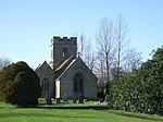
Hermitage, parish church of St. Mary geograph.org.uk 467783

Hermitage is a small village and civil parish in the county of Dorset in southern England. It is situated in the Blackmore Vale under the scarp of the Dorset Downs, 6 miles (9.7 km) south of the town of Sherborne. Dorset County Council's latest (2013) estimate of the parish population is 70.Augustinian monks once had a hermitage here (also known as the Blackmoor Priory Hermitage), whence the name of the village, but they abandoned the site in the 14th or 15th century. The Lady's Well which they used still remains, on the edge of woodland a short distance from the village.

Excerpt from the Wikipedia article Hermitage, Dorset (License: CC BY-SA 3.0, Authors, Images).

Hermitage, Dorset
Hartley Street,

Geographical coordinates (GPS) Address Nearby Places
placeShow on map

Wikipedia: Hermitage, DorsetContinue reading on Wikipedia

Geographical coordinates (GPS)

Latitude Longitude
N 50.859 ° E -2.504 °
placeShow on map

Address

Hartley Street

Hartley Street
DT2 7BB
England, United Kingdom
mapOpen on Google Maps

Hermitage, parish church of St. Mary geograph.org.uk 467783
Share experience

Nearby Places

Holnest
Holnest

Holnest is a village and civil parish in the county of Dorset in southern England. It lies in the Blackmore Vale 4 miles (6.4 km) south of Sherborne. It is a scattered village, sited on Oxford clay which is drained by a small stream called The Cam. The A352 main road passes through the village. Dorset County Council's 2013 mid-year estimate of the population of the parish is 220. In the 2011 national census the population of Holnest parish combined with the small parish of Lillington to the north was 342; figures have so far not been published for Holnest parish alone. Holnest parish church stands behind a wall and large gates close to the main road. The gates are the result of a mausoleum which used to stand in the churchyard. This had been built in 1872 by John Samuel Wanley Sawbridge Erle-Drax as part of his preparations for his own funeral, but no provision was made for its upkeep and after his death and interment in 1887 it fell into disrepair and was later demolished. A description of the building was given in 1906 by Sir Frederick Treves, who said it was "almost as large as the humble church" and "a gaudy building, in the Byzantine style, made up of grey and yellow stone, worried by much carving and enlivened by highly polished granite pillars. The rounded roof, which to be consistent should be of corrugated iron, is of lead.".The church, dedicated to the Assumption of the Blessed Virgin, dates largely to the 14th and 15th centuries. Largely left untouched by the Victorian restorers, it contains a number of interesting features, including a Jacobean pulpit, rare examples of Georgian box pews with curved candle sconces above, an original medieval barrel-vaulted roof in the south aisle. In June 2016, the Friends of Holnest Church was set up to support the Parochial Church Council in their efforts to maintain and restore the building and its grounds. In October 2016, author and historian, Adrian Tinniswood, was announced as their patron. Holnest Park House is an 18th-century listed building which has more recently been divided into flats. It was badly damaged by a fire in 2010.

Glanvilles Wootton
Glanvilles Wootton

Glanvilles Wootton, or Wootton Glanville, is a village and civil parish in the county of Dorset in southern England. It is situated in the Blackmore Vale under the scarp of the Dorset Downs, five miles (eight kilometres) south of Sherborne. In the 2011 Census the parish had a population of 196.To the north of the village is Round Chimneys Farm, which used to be a manor house and home of John Churchill, 1st Duke of Marlborough. The Farm, Grade II listed since 1960, "originated c.1590s, probably added to 1632 with extensive alterations and demolitions C19". One mile (1.5 kilometres) southeast of the village is the hill fort Dungeon Hill. According to Dorset OPC, "the name of the Parish was changed in 1985, having previously been Wootton Glanville". The Parish Church is St Mary the Virgin and its register starts at the year 1546. It has been Grade I listed since 1964 as "mainly C14" modifications made in the 15th century and the early 19th century. A great deal of additional historic information about the community and its structures is provided by a document titled An Inventory of the Historical Monuments in Dorset, Volume 3, Central. Originally published by Her Majesty's Stationery Office, London, 1970.One of the most significant properties in the area, The Manor House, Glanvilles Wootton, is a Georgian manor house, which incorporates an earlier 17th-century house, on 88 acres of parks, pastures and gardens, according to Country Life (magazine). The original house is believed to have been built circa 1616 by George Williams, originally from Wales; the newer Georgian home was built in 1804 by Glanvilles Wootton.The "MANOR HOUSE FARMHOUSE WOOTTON GLANVILLES FARM" has been Grade-II listed since 1974. The farm house appears to have originated in the mid 1800s but was modified circa 1978.

Cerne Abbas Giant
Cerne Abbas Giant

The Cerne Abbas Giant is a hill figure near the village of Cerne Abbas, in Dorset, England. It is currently owned by the National Trust, and listed as a scheduled monument of England. Measuring 55 metres (180 ft) in length, the hill figure depicts a bald, nude male with a prominent erection, holding his left hand out to the side and wielding a large club in his right hand. Like many other hill figures, the Cerne Giant is formed by shallow trenches cut into the turf and backfilled with chalk rubble. The origin and age of the figure are unclear, and archaeological evidence suggests that parts of it have been lost, altered, or added, over time; the earliest written record dates to the late 17th century. Early antiquarians associated it, albeit on little evidence, with a Saxon deity, while other scholars sought to identify it with a Romano-British figure of Hercules (or some syncretisation of the two). The lack of earlier descriptions, along with information given to the 18th-century antiquarian John Hutchins, has led some scholars to conclude it dates from the 17th century. Conversely, recent optically stimulated luminescence testing has suggested an origin between the years 700 CE and 1110 CE, possibly close to the 10th-century date of the founding of nearby Cerne Abbey. Regardless of its age, the Cerne Abbas Giant has become an important part of local culture and folklore, which often associates it with fertility. It is one of England's best-known hill figures and is a visitor attraction in the region. The Cerne Giant is one of two major extant human hill figures in England, the other being the Long Man of Wilmington, near Wilmington, East Sussex, which is also a scheduled monument.