Tehachapi, California
1909 establishments in CaliforniaCities in Kern County, CaliforniaCities in the Mojave DesertIncorporated cities and towns in CaliforniaPages including recorded pronunciations ... and 4 more
Populated places established in 1909Tehachapi, CaliforniaTehachapi MountainsUse mdy dates from December 2015

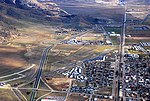
Tehachapi ( ; Kawaiisu: Tihachipia, meaning "hard climb") is a city in Kern County, California, United States, in the Tehachapi Mountains, at an elevation of 3,970 feet (1,210 m), between the San Joaquin Valley and the Mojave Desert. Tehachapi is 35 miles (56 km) east-southeast of Bakersfield, and 20 miles (32 km) west of Mojave. According to the United States Census Bureau, the city has a total area of 10 square miles (26 km2) and a population of 14,414. The Tehachapi area is known for the nearby Tehachapi Loop (a popular railfan site), the Pacific Crest Trail and for the excellent conditions for the aerial sport of gliding.
Excerpt from the Wikipedia article Tehachapi, California (License: CC BY-SA 3.0, Authors, Images).Tehachapi, California
West Tehachapi Boulevard,
Geographical coordinates (GPS) Address Nearby Places Show on map
Geographical coordinates (GPS)
| Latitude | Longitude |
|---|---|
| N 35.132222222222 ° | E -118.44888888889 ° |
Address
Kohnen's
West Tehachapi Boulevard 125
93561
California, United States
Open on Google Maps


