place

Bay Point, California

Bay Point, CaliforniaCensus-designated places in CaliforniaCensus-designated places in Contra Costa County, CaliforniaUse mdy dates from July 2023
Contra Costa County California Incorporated and Unincorporated areas Bay Point Highlighted

Bay Point, formerly West Pittsburg and originally Bella Vista is a census-designated place located in the East Bay region of the San Francisco Bay Area in Contra Costa County, California. Bay Point is just west of Pittsburg, California, and northeast of Concord, California, on the southern shore of Suisun Bay. The population of Bay Point was 21,349 as of 2010. The Pittsburg/Bay Point Station of the Bay Area Rapid Transit (BART) rail system is located adjacent to Bay Point in Pittsburg. The community is traversed by a freeway, State Route 4, the California Delta Highway. Being unincorporated, Bay Point does not have its own police department. The community is policed by the California Highway Patrol and the Contra Costa County Sheriff's Office. The ZIP code is 94565, and the area code is 925.

Excerpt from the Wikipedia article Bay Point, California (License: CC BY-SA 3.0, Authors, Images).

Bay Point, California
Riverside Drive,

Geographical coordinates (GPS) Address Nearby Places
placeShow on map

Wikipedia: Bay Point, CaliforniaContinue reading on Wikipedia

Geographical coordinates (GPS)

Latitude Longitude
N 38.029166666667 ° E -121.96166666667 °
placeShow on map

Address

Riverside Drive

Riverside Drive

California, United States
mapOpen on Google Maps

Contra Costa County California Incorporated and Unincorporated areas Bay Point Highlighted
Share experience

Nearby Places

Concord Naval Weapons Station

Concord Naval Weapons Station was a military base established in 1942 north of the city of Concord, California at the shore of the Sacramento River where it widens into Suisun Bay. The station functioned as a World War II armament storage depot, supplying ships at Port Chicago. During World War II it also had a Naval Outlying Field at the southern edge of the base. It ceased being an operating airfield after World War II. During the Korean War, the Vietnam War and the Gulf War, Concord NWS processed and shipped thousands of tons of materiel out across the Pacific Ocean.The station consisted of two areas: the Inland Area (5,028 acres (2,035 ha)), which is within the Concord city limits, and the Tidal Area (7,630 acres (3,088 ha)). Because of changes in military operations, parts of the Inland Area began to be mothballed, and by 1999 the station had only a minimal contingent of military personnel and contained mainly empty ammunition storage bunkers, empty warehouses, and disused support structures. In 2007, the U.S. federal government announced that the Inland Area of the Naval station would be closed. The Tidal area of the base was not scheduled for closure and reorganized as Military Ocean Terminal Concord (MOTCO). The 834th Transportation Battalion is the port manager at MOTCO and operates the three piers and an Army-owned rail system that connects with major public railway lines.The 5-member City Council of Concord, sitting as the federally designated Local Reuse Authority, is in the process of formulating a Reuse Plan for the Inland Area that includes residential and commercial development while reserving approximately two-thirds for open-space and parks projects. City staff are assigned to manage this effort. The Reuse Plan is subject to approval by the Navy.The East Bay Regional Park District will be receiving 2,540 acres (1028 hectares) of the Inland Area that will be developed for public use as Concord Hills Regional Park. Formal conveyance of the property was expected in early 2016 whereupon the property will be prepared for public access and recreation. Since then 2,216 acres were transferred from Navy property to park. In addition "2,300 acres will be transferred to the city of Concord, whose Concord Community Reuse Project has been overseeing planning for housing, businesses, a college campus and other development.".

GoMentum Station

GoMentum Station is a testing ground for connected and autonomous vehicles at the former Concord Naval Weapons Station (CNWS) in Concord, California, United States. The property was acquired and repurposed by the Contra Costa Transportation Authority, acquired in August 2018 by AAA Northern California, Nevada & Utah.In October 2014, the Contra Costa Transportation Authority announced that the GoMentum Station proving grounds would be used to test self-driving cars; according to them, "The public will not have access to the test site, and the self-driving cars will be restricted to the test bed site. With 2,100 acres (850 ha) of testing area and 19.6 miles (31.5 km) of paved roadway, the CNWS is currently the largest secure test bed site in the United States". Mercedes-Benz is reported to have licenses to test new driving technology, including smart infrastructure such as traffic signals that communicate with cars. Among the site's other notable features: "a 7-mile (11 km)-long roadway is great for testing high-speed driving, and a pair of 1,400-foot (430 m)-long tunnels" for sensor testing.Among the roughly 30 partners listed on the company's site are automakers Toyota and Honda, ridesharing companies Uber and Lyft and China-based autonomous driving company Baidu. In summer 2015, reports suggested the Apple electric car project was interested in using the site, as members of Apple's Special Project group were reported to have met GoMentum representatives but there were no subsequent reports of Apple personnel and vehicles actually using the site.In August 2019, GoMentum announced the October launch of its V2X (vehicles-to-everything) testing facility.

Chipps Island
Chipps Island

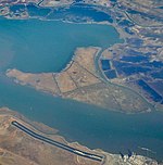
Chipps Island is a small island in Suisun Bay, California. It is part of Solano County. It is also known as Knox Island, Its coordinates are 38°03′19″N 121°54′43″W by which name it appears on an 1850 survey map of the San Francisco Bay area made by Cadwalader Ringgold, as well as an 1854 map of the area by Henry Lange. In 1959, the state of California used Chipps Island in a legal definition of the western boundary of the Sacramento–San Joaquin River Delta.In 1960s, during efforts to devise large-scale hydrological engineering projects in San Francisco Bay and adjacent estuaries, Chipps Island was proposed as the site of a dam across the Carquinez Strait as a "more feasible" alternative to the very expensive Reber Plan. The Chipps Island dam was estimated to cost $194,400,000 in 1963 ($1.86 billion in 2022), and retain 1,380,000 acre⋅ft (1.70×10⁹ m3) of fresh water (which would otherwise be emptied into the Pacific Ocean). However, the project faced barriers to implementation, including potential hazards to wildlife (as it was expected to cause the flow of the San Joaquin River to reverse during part of salmon's migration period, preventing them from swimming upstream). The Sacramento Bee quoted "state fish and wildlife experts" as saying that the "seriousness of this apparently insolvable problem" was significant enough to "postpone further investigation of the other effects of the Chipps Island plan". By 1964, new plans from the Inter-Agency Delta Committee had "discarded" the Chipps Island water barrier in plans for managing freshwater in the region.Chipps Island is located close to hydrocarbon deposits, and in 1967, bids were opened for oil and gas rights on parcels in the vicinity of the island.While a duck club had once operated on Chipps Island, it was in disuse by the mid-1970s; in 1974, police arrested a "bustling" ring of illicit amphetamine producers using the abandoned structures to store large amounts of the stimulant.In the 2010s, Chipps Island was part of a large purchase of Delta land attempted by the Metropolitan Water District of Southern California (along with nearby Bouldin and Bacon Islands, as well as much of the Holland and Webb Tracts). The district was subsequently sued by several northern California environmental groups, water agencies, and the counties of Contra Costa and San Joaquin.