Ashland, California

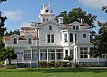
Ashland is a census-designated place (CDP) and unincorporated community in Alameda County, California, United States. The population was 23,823 at the 2020 census. Ashland is located between the city of San Leandro to the north, the unincorporated community of Cherryland to the south, the unincorporated community of Castro Valley to the east, and the unincorporated community of San Lorenzo to the southwest. Ashland shares a postal zip code with the neighboring unincorporated community of San Lorenzo to the southwest, as well as the close by cities of Hayward to the south and San Leandro to the north. There is no documented evidence that Ashland was ever known as “San Leandro South” but instead has been informally, albeit incorrectly, known as "unincorporated San Leandro" or "unincorporated Hayward" since Ashland does not have its own postal zip code designation.
Excerpt from the Wikipedia article Ashland, California (License: CC BY-SA 3.0, Authors, Images).Ashland, California
164th Avenue,
Geographical coordinates (GPS) Address Nearby Places Show on map
Geographical coordinates (GPS)
| Latitude | Longitude |
|---|---|
| N 37.694722222222 ° | E -122.11388888889 ° |
Address
164th Avenue
164th Avenue
94580
California, United States
Open on Google Maps


