place

Sharpness

Populated places on the River SevernPorts and harbours of GloucestershireStroud DistrictUse British English from March 2015Villages in Gloucestershire
070605 uk glos sharpness

Sharpness ( sharp-NESS) is an English port in Gloucestershire, one of the most inland in Britain, and eighth largest in the South West England region. It is on the River Severn at grid reference SO669027, at a point where the tidal range, though less than at Avonmouth downstream (14 metres (46 ft) typical spring tide), is still large (10 metres (33 ft) typical spring). There is a small community of approximately 100 residents directly adjacent to the port, in addition to the subvillage of Newtown approximately 0.5 miles to the south-east. Four miles to the south lies the small town of Berkeley.

Excerpt from the Wikipedia article Sharpness (License: CC BY-SA 3.0, Authors, Images).

Geographical coordinates (GPS)

Latitude Longitude
N 51.723 ° E -2.478 °
placeShow on map

Address

TS Vindicatrix

Dock Road
GL13 9UA
England, United Kingdom
mapOpen on Google Maps

070605 uk glos sharpness
Share experience

Nearby Places

Severn Railway Bridge

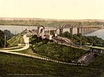
The Severn Railway Bridge (historically called the Severn Bridge) was a bridge carrying the railway across the River Severn between Sharpness and Lydney in Gloucestershire, England. It was built in the 1870s by the Severn Bridge Railway Company, primarily to carry coal from the Forest of Dean to the docks at Sharpness; it was the furthest-downstream bridge over the Severn until the opening of the Severn road bridge in 1966. When the company got into financial difficulties in 1893, it was taken over jointly by the Great Western Railway and the Midland Railway companies. The bridge continued to be used for freight and passenger services until 1960, and saw temporary extra traffic on the occasions that the Severn Tunnel was closed for engineering work. The bridge was constructed by Hamilston's Windsor Ironworks Company Limited of Garston, Liverpool. It was approached from the north via a masonry viaduct and had twenty-two spans. The pier columns were formed of circular sections, bolted together and filled with concrete. The twenty-one regular wrought iron spans were then put in place, as well as the southernmost span, the swing bridge over the Gloucester and Sharpness Canal. The bridge was 4,162 ft (1,269 m) long and 70 ft (21 m) above high water. 6,800 long tons (7,600 short tons; 6,900 t) of iron were used in its construction. A number of accidents took place at the bridge over the years, with vessels colliding with the piers due to the strong tides. In 1960 two river barges hit one of the piers on the bridge, causing two spans to collapse into the river. Repair work was under consideration when a similar collision occurred the following year, after which it was decided that it would be uneconomical to repair the bridge. It was demolished between 1967 and 1970, with few traces remaining.

Purton, Lydney
Purton, Lydney

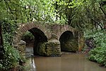
Purton is a hamlet on the west bank of the River Severn, in the civil parish of Lydney in Gloucestershire, England. It lies opposite the village of Purton near Berkeley on the east bank of the river. The name of the place derives from the Old English pirige tun, meaning "pear orchard". It was mentioned in the Domesday Book. Purton was a small port, and there was a ferry across the river, Purton Passage, to the other Purton by 1282. In the late 18th and early 19th century, there was also a ford across the river here. In 1740, the removal of a large rock from the river bed on the Berkeley side caused the river to shift its channel. This meant only a single crossing a day was possible and led to a decline in the trade. The river had returned to its old channel ten years later, although it was altered by another shift in 1761. In the late 18th century and the early 19th the river was often forded at Purton, but some people, misjudging the tide times, were drowned. The ferry continued in use until 1879, when it was replaced by the Severn Railway Bridge.The manor house is a Grade II* listed building. It dates from 1618 and lies immediately above the Chepstow/Gloucester railway line which passes in a deep cutting at that point. It has a principal block, of three storeys and three bays, parallel with the river and a wing which projects to the north-east, with a small extension added in the 19th century. Historic England, in its listing record, describes the manor house as "an important survival, somewhat modified over the centuries". A barn to the west of the manor house is listed at Grade II. Old Severn Bridge House, which Verey and Brooks note was formerly a hotel, is also Grade II listed.To the north of the hamlet, the Purton Viaduct crosses the road from Etloe. Designed in 1830, and contemporary with the Stockton and Darlington Railway, it was planned as part of a crossing of the Severn, the Purton Steam Carriage Road which was never completed. Historic England consider the viaduct of "considerable historical and industrial archaeological interest".