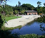
Robert Sibley Volcanic Regional Preserve
Berkeley HillsEast Bay Regional Park DistrictGeology of Alameda County, CaliforniaGeology of Contra Costa County, CaliforniaParks in Alameda County, California ... and 4 more
Parks in Contra Costa County, CaliforniaParks in the San Francisco Bay AreaPliocene CaliforniaVolcanism of California

Robert Sibley Volcanic Regional Preserve is located in the Oakland Hills of the East Bay region of the San Francisco Bay Area, California. The park is part of the East Bay Regional Parks District (EBRPD), covers 928 acres (3.76 km2), and lies east of Oakland, partly in Alameda County and partly in Contra Costa County. It can be entered from Oakland via Skyline Boulevard, or from Contra Costa County via Old Tunnel Road.
Excerpt from the Wikipedia article Robert Sibley Volcanic Regional Preserve (License: CC BY-SA 3.0, Authors, Images).Robert Sibley Volcanic Regional Preserve
Quarry Road,
Geographical coordinates (GPS) Address Nearby Places Show on map
Geographical coordinates (GPS)
| Latitude | Longitude |
|---|---|
| N 37.85495 ° | E -122.20326 ° |
Address
Quarry Road
Quarry Road
94563
California, United States
Open on Google Maps


