place

West Stockwith

Bassetlaw DistrictCivil parishes in NottinghamshireEngvarB from May 2016Villages in Nottinghamshire
Church of St Mary the Virgin in West Stockwith geograph.org.uk 4714328

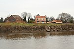
West Stockwith is a village within the Bassetlaw district of Nottinghamshire, England. The population at the 2011 census was 327, this increased to 335 at the 2021 census. It lies on the west bank of the River Trent, 3 miles (4.8 km) north-west of Gainsborough and 1.5 miles (2.4 km) east of Misterton. West Stockwith is an ecclesiastical parish in the Church of England Diocese of Southwell and Nottingham with the parish church of St Mary the Virgin's Church, West Stockwith being built in 1722. East Stockwith is a settlement on the other side of the Trent, but within the county boundaries of Lincolnshire. The two villages were once linked together by a passenger ferry.

Excerpt from the Wikipedia article West Stockwith (License: CC BY-SA 3.0, Authors, Images).

West Stockwith
Main Street, Bassetlaw

Geographical coordinates (GPS) Address Nearby Places
placeShow on map

Wikipedia: West StockwithContinue reading on Wikipedia

Geographical coordinates (GPS)

Latitude Longitude
N 53.444 ° E -0.811 °
placeShow on map

Address

Main Street

Main Street
DN10 4HA Bassetlaw
England, United Kingdom
mapOpen on Google Maps

Church of St Mary the Virgin in West Stockwith geograph.org.uk 4714328
Share experience

Nearby Places

Trent Aegir
Trent Aegir

The Trent Aegir, also known as the Eagre, is a tidal bore on the River Trent in England. At certain times of the year, the lower tidal reaches of the Trent experience a moderately large bore (up to five feet (1.5m) high). It is said to take its name from Ægir, a personification of the sea in Norse mythology, although this is disputed. A more likely derivation is from Old English ēagor (“flood, stream, water”).The Aegir occurs when a high spring tide meets the downstream flow of the river. The funnel shape of the river mouth exaggerates this effect, causing a large wave to travel upstream as far as Gainsborough, Lincolnshire, and sometimes beyond. The Aegir cannot travel much beyond Gainsborough as the shape of the river reduces the Aegir to little more than a ripple, and weirs north of Newark-on-Trent, Nottinghamshire stop its path completely. The Aegir can be seen at Gainsborough, Morton, East Stockwith, West Stockwith and Owston Ferry. The Environment Agency used to publish predictions for the occurrence of the bore, but now no longer provide these. The United Kingdom Hydrographic Office (UKHO) provides useful tidal prediction information. The UKHO have a free tidal prediction service which provides tidal times for the forthcoming week. A private prediction of the Aegir is regularly updated on an informational site about the neighbouring community of Crowle, Lincolnshire.It is alleged that King Cnut performed his purposely unsuccessful attempt to turn the tide back in the River Trent at Gainsborough. If this is the case, it is highly probable that Cnut was attempting to turn the Aegir tide.The Aegir features in Chapter 5 of George Eliot's The Mill on the Floss (1860): "Above all, the great Floss, along which they wandered with a sense of travel, to see the rushing spring-tide, the awful Eagre, come up like a hungry monster."

Morton, West Lindsey

Morton is a suburban village and civil parish in the West Lindsey district in Lincolnshire, England. The population at the 2011 census was 1,325. It is 1 mile (1.6 km) north of Gainsborough on the River Trent and forms part of a built-up area with the town. Morton is listed in the 1086 Domesday Book as "Mortune", with four households. It was a township of Gainsborough parish until 1846, when the first church, dedicated to Saint Paul, opened in the village. The church then became a chapelry, until 1866, when Morton was created a civil parish.The Grade II* listed church is dedicated to Saint Paul. The current building dates from 1890 to 1891 and was built to the designs of J. T. Micklethwaite and Somers Clarke, incorporating the tower of the church consecrated in 1846, which appears to have been re-faced. The width of the 1840s church decided the width of the nave of the current church. An 1890-91 building campaign was largely financed by the then Premier Baronet, Sir Hickman Becket Bacon, at a cost of £11,000. The church includes a chapel to Saint Hugh off the south aisle. Of note is the chancel carpet designed by William Morris and stained glass windows by Burne-Jones, executed by Morris & Co.Morton Trentside Primary School was built in 1843 as a National school. It was enlarged in 1871, and an infant schoolroom was added in 1882. It became Morton County Primary School in 1947 and in 1985-86 moved to a new site near to Morton playing fields. It took its present name in September 1999.The Manor House is a red-brick Grade II listed building dating from the mid-18th century with later alterations and additions, now part of an office complex.