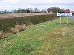
Gribthorpe
East Riding of Yorkshire geography stubsOpenDomesdayUse British English from December 2014Villages in the East Riding of Yorkshire
Gribthorpe is a hamlet in the East Riding of Yorkshire, England. It is situated approximately 8 miles (13 km) north-east of Selby and 5 miles (8 km) north of Howden. Gribthorpe forms part of the civil parish of Foggathorpe. In 1823, Gribthorpe (also known as Gripthorpe), was in the civil parish of Bubwith and the Wapentake of Harthill. Population at the time, including the nearby hamlet of Willitoft, was 145, with occupations including four farmers.
Excerpt from the Wikipedia article Gribthorpe (License: CC BY-SA 3.0, Authors).Gribthorpe
Geographical coordinates (GPS) Address Nearby Places Show on map
Geographical coordinates (GPS)
| Latitude | Longitude |
|---|---|
| N 53.810599 ° | E -0.84669 ° |
Address
DN14 7NT , Foggathorpe
England, United Kingdom
Open on Google Maps


