Hale, Greater Manchester

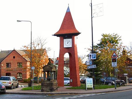
Hale is a suburb and electoral ward within the Metropolitan Borough of Trafford, in Greater Manchester, England. The population of the village taken at the 2011 census was 15,315. It is contiguous with the southeast of Altrincham, about 9 mi (14 km) southwest of the city of Manchester. Located within the boundaries of the historic county of Cheshire, the earliest documented reference to Hale is in the Domesday Book of 1086, although the name of the settlement is probably as old as 7th or 8th century. The area was mostly agricultural. Hale grew in the Middle Ages to the point when Hale Barns was established as a separate settlement. Hale was formerly in Cheshire. Hale, Bowdon and Hale Barns together are regarded as the wealthiest areas in Greater Manchester and outside of London, and similarly wealthy to Golden Triangle towns Wilmslow, Alderley Edge and Prestbury in Cheshire. These towns and the area between them contain some of the most expensive properties in the United Kingdom outside London.
Excerpt from the Wikipedia article Hale, Greater Manchester (License: CC BY-SA 3.0, Authors, Images).Hale, Greater Manchester
Cecil Road, Trafford Hale
Geographical coordinates (GPS) Address Nearby Places Show on map
Geographical coordinates (GPS)
| Latitude | Longitude |
|---|---|
| N 53.377 ° | E -2.347 ° |
Address
Cecil Road
Cecil Road
WA15 9PA Trafford, Hale
England, United Kingdom
Open on Google Maps


