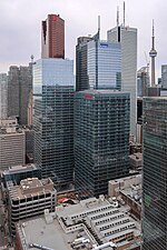
Path (Toronto)

Path (stylized as PATH) is a network of underground pedestrian tunnels, elevated walkways, and at-grade walkways connecting the office towers of Downtown Toronto, Ontario, Canada. It connects more than 70 buildings via 30 kilometres (19 mi) of tunnels, walkways, and shopping areas. According to Guinness World Records, Path is the largest underground shopping complex in the world, with 371,600 square metres (4,000,000 sq ft) of retail space which includes over 1,200 retail fronts (2016). As of 2016, over 200,000 residents and workers use the Path system daily with the number of private dwellings within walking distance at 30,115.The Path network's northern point is the Atrium on Bay at Dundas Street and Bay Street, including a now-closed tunnel to the former Toronto Coach Terminal, while its southern point is Waterpark Place on Queens Quay. Its main north–south axes of walkways generally parallel Yonge and Bay Streets, while its main east–west axis parallels King Street. There is continuous expansion of the Path system around Union Station. Two towers being built as part of CIBC Square will be linked to the Path system, extending it to the east to cross over Yonge Street by a pedestrian bridge into the Backstage Condominium building (Esplanade and Yonge corner), giving closed access to Union Station, Scotiabank Arena, and other buildings in Toronto's Financial District.
Excerpt from the Wikipedia article Path (Toronto) (License: CC BY-SA 3.0, Authors, Images).Path (Toronto)
Adelaide Street West, Old Toronto
Geographical coordinates (GPS) Address Nearby Places Show on map
Geographical coordinates (GPS)
| Latitude | Longitude |
|---|---|
| N 43.65 ° | E -79.38 ° |
Address
Adelaide Street West
M5H 4E3 Old Toronto
Ontario, Canada
Open on Google Maps


